Laminium
The Roman Laminium acquired the status of Flavian municipality (municipio flavio), with the privileges that it entailed, like other cities such as Complutum, Toletum or Consaburum, which leads us to believe that it would have a certain importance in terms of civil and religious works.
Based on works from the Muslim and medieval periods, other authors determine that, as for the Romans, the sources of the Anas River would have been located in the Córcoles-Sotuélamos system or in the Lagunas de Ruidera (Alto Guadiana).
Throughout history, the city of Laminium has been located in many different places within a very large area that, although entirely in the natural region of La Mancha, covers parts of the provinces of Ciudad Real and Albacete.
He argues in favor of its proximity to one of the places considered to be the source of the Guadiana River and its location near the Tablas de Daimiel, suggesting that, etymologically, Laminio would mean something similar to 'city of the lakes' or 'the marshes'.
Against this theory is adduced the excessive distance that exists from Libisosa (more than 70 km), the fact of having taken into account a modern hypothesis of the source of the Guadiana River, the lack of certainty about the etymology of Laminio and the little Roman archaeological evidence in the area.
The success of the theory of Luis Andrés Domingo Puertas has allowed a breakthrough in the knowledge of Roman antiquity in Ciudad Real, with studies such as those of Moya-Maleno (2008), Benítez de Lugo or Gómez Torrijos (2011).
In its defense, we find that the location of Alhambra corresponds to the model of Oppida Carpetanos, numerous remains of Roman pedestals, inscriptions, statues and two necropolises have been discovered in the urban area, indicating that the place was a municipality in the Flavian period.
[6] Alhambra also shares acceptable distances with Caput Flumini Anae (Lagunas de Ruidera) and with Libisosa, in addition to having a road that, effectively, goes to Consuegra on one side and, on the other, to Cástulo through Barranco Hondo.
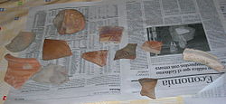
In addition, in its vicinity (El Puerto de Vallehermoso or La Fuenlabrada according to the authors)[7] has been found the only inscription of the entire province that makes direct reference to Laminium.
Inscription from Puerto de Vallehermoso or La Fuenlabrada (E. Hübner, CIL II, 3228)The references to Laminio may be merely circumstantial since, on many occasions, the remains of abandoned cities were reused in others, as a quarry.
The second one should be rejected because the remains found suggest the existence of a much older population (Bronze Age), perfectly logical within the very important group of motillas of the Lagunas de Ruidera, with a very scarce Roman survival.
All these locations have the Córcoles River as a common link, in whose banks and in those of its tributaries there are abundant vestiges of settlements and other testimonies of population from very ancient times along its entire route through different municipalities of Albacete and Ciudad Real.
In fact, the etymology of the hydronym Córcoles (kurkotz) is considered by specialists to be Iberian and the name of the river from which it flows, the Záncara, has been written –Querzáqqara or Ciudad del Záncara– on a bronze object found in the Fosos de Bayona (Huete).
However, what is currently documented and studied is very little and deficient, and it does not seem to have enough importance and extension to be the great municipality that can be deduced from the classical and epigraphic testimonies and places us rather in front of settlements related to the Culture of the Motillas (of Morra type facies) that were evolving and extending their existence, in some cases, until the Iberian period and in others, until the first Taifas.
It has been speculated that it was razed during the first years of the Visigothic invasion around 409 A.D. and its remains have been repeatedly plundered; or else, due to its location in marshy areas or near a river, the city succumbed to a terrible flood.
Currently, a new hypothesis on "telluric cataclysms" is beginning to be formulated, mainly on the basis of the excavations and archaeological samples that are being studied in the Ibero-Roman city of Libisosa (Lezuza), where wall collapses have been found that are difficult to explain if not for a theory of local seismic movements, affecting at least, in the first instance, the region of eastern Laminium, cited by the Itinerary of Antoninus, and inventoried as A31, where Laminium is cited very close to the headwaters of the Guadiana River, possibly where there was a permanent military garrison, about 10 km away (Caput Fluminius Anae); and the Roman colony of Libisosa, another 21 km away.