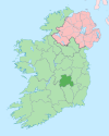
County Laois
The first people in Laois were bands of hunters and gatherers who passed through the county about 8,500 years ago[citation needed].
They hunted in the forests that covered Laois and fished in its rivers, gathering nuts and berries to supplement their diets.
Visitors to the county can see a stone circle they left behind at Monamonry, as well as the remains of their hill forts at Clopook and Monelly.
For the first time, iron appeared in Ireland, showing up in the weapons used by factions who fought bloody battles for control of the land.
The Synod of Rathbreasail that established the Irish dioceses was held near Mountrath in 1111, moving the Church away from its monastic base.
The Augustinians and Dominicans established themselves at Aghaboe Abbey, while the Cistercians took over an older religious community at Abbeyleix.
In Laois, the fortress on the Rock of Dunamase was part of the dowry of the Irish princess Aoife, who was given in marriage in 1170 to the Norman warrior Strongbow.
Advancing Normans surveyed the county from wooden towers built on top of earthen mounds, known as mottes.
Several of the county's towns were first established as Norman boroughs, including Castletown, Durrow and Timahoe.
From 1175 until about 1325, Normans controlled the best land in the county, while Gaelic society retreated to the bogs, forests and the Slieve Bloom Mountains.
Examples of tower houses built by the Irish Mac Giolla Phádraig chieftains are found at Ballaghmore and Cullahill Castle, both decorated with Sheela na gigs.
In 1548, the English confiscated the lands of the O’Mores and built "Campa", known as the Fort of Leix, today's Portlaoise.
During the first plantation, Thomas Radclyffe, 3rd Earl of Sussex attempted to dispossess the ruling O'Moore clan, who had been engaging in costly raids on The Pale, and settle the area with English colonists.
However, this led to a long drawn-out guerrilla war in the county and left only a small colonist community clustered around garrisons.
This initial attempt at plantation is widely regarded as a failure by historians, as occupying the territory was far more costly than the money yielded from it, and the scheme attracted fewer settlers than anticipated.
In addition, a Met Éireann climatological station (Number: 472) was installed in September 2010 and the data collected is sent to headquarters in Glasnevin, Dublin on a monthly basis.
The climatological station is a project that is envisaged to last thirty years and collect a climate profile for Durrow and Laois in general.
It has 19 councillors, and is divided into three local electoral areas, each of which is also a municipal district: Borris-in-Ossory-Mountmellick (6), Graiguecullen-Portarlington (6), and Portlaoise (7).
[25] County Laois also has a mixture of castles, mansions, forts and old structures that are now in ruins but are still worth visiting.
[26] The population of County Laois is expanding, given its easy commute to the employment centres of Kildare and Dublin.
[needs update] Agricultural activities occupy approximately 70% of the land area of the county (1,200 km2 or 460 sq mi).
[30] The remaining area includes considerable stretches of raised bog and the Slieve Bloom mountains, which are partially covered by coniferous forest.
There are many festivals held in Laois each year including: Iarnród Éireann train services along the Dublin-Cork line connects the county between Heuston station and Cork, Limerick, travel through the county, with railway stations at Portarlington, Portlaoise and Ballybrophy.
All major traffic bottlenecks in Laois such as Abbeyleix and Mountrath have been bypassed following the opening of the M7/M8 tolled motorway project in May 2010.
Both towns were major intercity bottlenecks for motorists, especially Abbeyleix where delays of up to 30 minutes or more were common.