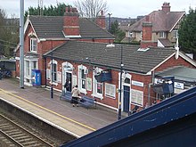
Leagrave
The village of Leagrave was recorded in 1224 as Littegraue, intimating that its name means 'Light-coloured, or lightly wooded, grove'.
[4] A place spelt as Lythtegrave (which may refer to Leagrave, since the prior of Dunstaple also features, and the county margination is Bedfordshire) appears in 1396.
[5] The first settlement in the area was Waulud's Bank which is a Neolithic D-shaped enclosure in Leagrave Park at the source of the River Lea and is now a protected monument.
Leagrave Marsh used to be a popular place for the Luton hatters on their (rare) days off and was, consequently, known as "Blockers' Seaside".
In 1914 Hewlett & Blondeau Limited, an aircraft manufacturing business, opened a factory at Leagrave called The Omnia Works.
[10] The area grew significantly in between the wars and on 1 October 1928 the parish was abolished when the boundaries of Luton were extended to include Leagrave, as well as Limbury and Stopsley.
Until the 1990s Electrolux was one of the larger employers in the area; however, much of the old factory site was sold off in the early 2000s for redevelopment into housing.
The Sugar Loaf pub was also located on the high street, but this has since been converted into a restaurant and then more recently renovated into flats.
There is a parade of shops on High Street/Grange Avenue at the centre of Leagrave, as well as a busy commercial area on the border with Limbury on Marsh Road.
Electrolux has moved its UK headquarters back to the area, based in one of the old Omnia Works buildings on Oakley Road.
The park also includes areas of County Wildlife designation, Leagrave Common and the Scheduled Monument, Waulud's Bank a 4500-year-old Neolithic enclosure.
[13] The largest church in the parish is St Lukes on Leagrave High Street, which was consecrated by the Bishop of Saint Albans in June 1956.
[14] It is a grade II listed building[15][16] due largely to its frontage,[17] and was designed by John Seely and Paul Paget.
Neighbouring areas are Hockwell Ring and Sundon Park to the north, Challney and Maidenhall to the south, Lewsey to the west, and Marsh Farm and Limbury to the east.
The festival usually takes place in the grounds and building of St Luke's Church and features a combination of stages, local performances and youth groups.
[26] The ward forms part of the parliamentary constituency of Luton North and the MP is Sarah Owen.