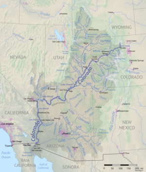
Lees Ferry
Glen Canyon Dam impounds the Colorado a short distance upstream and completely regulates the river flow past Lees Ferry.
[4] The surrounding valley formed because of a swell in the underlying rock of the Colorado Plateau that caused the regional elevation to intersect the Chinle and Moenkopi Formations, deposited in the Triassic about 208–245 million years ago.
[8] Because these are more easily eroded than the rock layers that lie above and below them, the Colorado Plateau gradually slopes down to river level at Lees Ferry through a series of flat benchlands.
[11][12] The first Europeans who happened upon Lees Ferry were members of the 18th-century Domínguez–Escalante expedition, an attempt to find an overland route through the Southwest between Spanish settlements in present-day New Mexico and California, and in the process, to convert as many Southwestern Native Americans as possible to Christianity.
When the explorers arrived at Lees Ferry in October, they found the river too wide and deep and had no choice but to head for the second ford more than 40 miles (60 km) upstream.
[15] This point, now submerged under Lake Powell, is named Crossing of the Fathers after Francisco Atanasio Domínguez and Silvestre Vélez de Escalante, the two Franciscan priests who headed the expedition.
Jacob Hamblin successfully crossed the river here in 1864, and during the next few years the Mormon presence swelled to the scale of a small military outpost (Lee's Ferry Fort) in order to defend against Navajo raids.
[11] In 1857, Lee had taken part in the Mountain Meadows Massacre, in which a group of Mormons and Native Americans attacked a passing non-Mormon wagon train from Arkansas, killing about 120 people.
The ill-conceived attack was the result of several factors including hysteria surrounding the 1857 "Utah War"[20] and animosity toward Arkansans after the murder of Mormon apostle Parley P. Pratt near Van Buren, Arkansas.
[17] The location of the ferry upstream from the Paria River confluence required passengers to traverse a dangerous incline nicknamed "Lee's Backbone" on their ascent up the south wall of the valley.
[11] In 1896 the ferry was transferred to Jim Emett, who installed a cable across the Colorado River to reduce the risk of boats washing downstream during high water.
[22] The most extravagant investment was a full-scale mining operation led by Charles H. Spencer, head of the American Placer Company, who came to Lees Ferry in 1910 planning to extract gold from the Chinle Formation.
[24] Since August 1921, Lees Ferry has been the site of a stream gage operated by the U.S. Geological Survey and has since accumulated one of the most extensive streamflow records ever made in the United States.
[31] To fully utilize these allocations and prevent water from "wasting" to the ocean, the U.S. federal government constructed a number of large storage dams on the Colorado River system.
[34] The filling of the resulting Lake Powell of 24.3 million acre feet (30.0 km3) inundated the Crossing of the Fathers, Charles Spencer's old mining operation, and other historic landmarks of the area.
The main access is by Lees Ferry Road, which splits off from U.S. Route 89A at the hamlet of Marble Canyon, Arizona, on the west side of the Navajo Bridges.
[44] This reach of the Colorado River is also well known for its status as a Blue Ribbon fishery, thanks to releases of cold, clear water from Glen Canyon Dam that make conditions ideal for introduced rainbow trout.