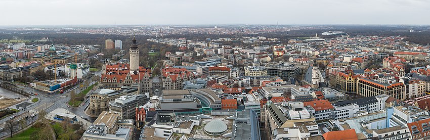
Leipzig-Mitte
Not far from there, the long-distance trade routes Via regia and Via imperii crossed in the Middle Ages,[5][6] with the latter still being present in today's street name Reichsstraße.
[8] Today's Mitte borough, on the other hand, also includes the suburbs, which essentially only developed after the gradual removal of the walls and ditches after the Seven Years' War.
An important prerequisite for the development of its northwestern, western and southwestern areas were the plans of the hydraulic engineers Kohl and Georgi in the years 1852 to 1854 and the subsequent redesign of the Leipzig River Network.
However, this does not change the fact that, as Sebastian Ringel proves,[16] hardly one stone has been left unturned and many buildings have been replaced by new ones over the course of time.
Starting with the construction of the main train station, through the bombing of Leipzig in World War II (degree of destruction in the Mitte borough between 34 and 52%)[17] and the changing reconstruction in the GDR,[18] entire squares and streets disappeared.
In 1989, the Mitte district made its place in world history with the Leipzig Monday demonstrations, which accelerated the end of the GDR and the Eastern bloc.