Levee
The Roman chronicler Tacitus mentions that the rebellious Batavi pierced dikes to flood their land and to protect their retreat (70 CE).
Similar to Dutch, the English origins of the word lie in digging a trench and forming the upcast soil into a bank alongside it.
In the English Midlands and East Anglia, and in the United States, a dike is what a ditch is in the south of England, a property-boundary marker or drainage channel.
[8] In parts of Britain, particularly Scotland and Northern England, a dyke may be a field wall, generally made with dry stone.
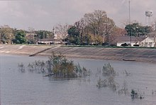
Levees can be mainly found along the sea, where dunes are not strong enough, along rivers for protection against high floods, along lakes or along polders.
Some of the earliest levees were constructed by the Indus Valley civilization (in Pakistan and North India from c. 2600 BCE) on which the agrarian life of the Harappan peoples depended.
However, others point to evidence of large-scale water-control earthen works such as canals and/or levees dating from before King Scorpion in Predynastic Egypt, during which governance was far less centralized.
Another example of a historical levee that protected the growing city-state of Mēxihco-Tenōchtitlan and the neighboring city of Tlatelōlco, was constructed during the early 1400s, under the supervision of the tlahtoani of the altepetl Texcoco, Nezahualcoyotl.
Because flood discharge intensity increases in levees on both river banks, and because silt deposits raise the level of riverbeds, planning and auxiliary measures are vital.
The effects of erosion are countered by planting suitable vegetation or installing stones, boulders, weighted matting, or concrete revetments.
During the Chinese Warring States period, the Dujiangyan irrigation system was built by the Qin as a water conservation and flood control project.
[12] The United States Army Corps of Engineers (USACE) recommends and supports cellular confinement technology (geocells) as a best management practice.
Artificial levees can lead to an elevation of the natural riverbed over time; whether this happens or not and how fast, depends on different factors, one of them being the amount and type of the bed load of a river.
The biggest of these are the huge levees in the Netherlands, which have gone beyond just defending against floods, as they have aggressively taken back land that is below mean sea level.
They are elongated ridges of mud and/or silt that form on the river floodplains immediately adjacent to the cut banks.
Deposition of levees is a natural consequence of the flooding of meandering rivers which carry high proportions of suspended sediment in the form of fine sands, silts, and muds.
For similar reasons, they are also common in tidal creeks, where tides bring in large amounts of coastal silts and muds.
Predicting soil erosion and scour generation when overtopping happens is important in order to design stable levee and floodwalls.
Briaud et al. (2008)[19] used Erosion Function Apparatus (EFA) test to measure the erodibility of the soils and afterwards by using Chen 3D software, numerical simulations were performed on the levee to find out the velocity vectors in the overtopping water and the generated scour when the overtopping water impinges the levee.
Hughes and Nadal in 2009[20] studied the effect of combination of wave overtopping and storm surge overflow on the erosion and scour generation in levees.
According to the laboratory tests, empirical correlations related to average overtopping discharge were derived to analyze the resistance of levee against erosion.
ERT can thus be used in monitoring of seepage phenomena in earth structures and act as an early warning system, e.g., in critical parts of levees or embankments.
[23] Large scale structures designed to modify natural processes inevitably have some drawbacks or negative impacts.
[24] In many cases, the impact is two-fold, as reduced recurrence of flooding also facilitates land-use change from forested floodplain to farms.
If levees keep the floodwaters inside a narrow channel, the water is delivered downstream over a shorter time period.
[27] In coastal areas, this results in land dipping below sea level, the ocean migrating inland, and salt-water intruding into freshwater aquifers.
[28] Where a large river spills out into the ocean, the velocity of the water suddenly slows and its ability to transport sand and silt decreases.
During subsequent flood events, water spilling out of the channel will find a shorter route to the ocean and begin building a new delta.

- Design high water level (HWL)
- Low water channel
- Flood channel
- Riverside slope
- Riverside banquette
- Levee crown
- Landside slope
- Landside banquette
- Berm
- Low water revetment
- Riverside land
- Levee
- Protected lowland
- River zone