Lewisham, New South Wales
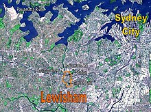
Lewisham is located 7 kilometres south-west of the Sydney central business district, in the local government area of Inner West Council.
Lewisham took its name in 1834 from the estate of Joshua Frey Josephson, a German-born businessman who would later become mayor of Sydney.
[3] The estate was named after the London borough of Lewisham, which means Leofsa's village or manor.
While the first governor Arthur Phillip tried to establish cordial relations with the Cadigals and their neighbours, the two groups were competing for the same food sources and tensions inevitably developed.
This provides access to Sydney CBD, the interchange station of Strathfield and the commercial centres of Burwood, Newtown and Parramatta.
Access to the city is quicker by conventional train, but the light rail may be used for some cross-regional journeys.
The 413 bus service, between Campsie and the city, cuts through the middle of Lewisham and provides an interchange with the railway station.
The Servants of Mary Help of Christians operated its Marian Centre from St Thomas Becket Primary School Hall.
After Australia (62.1%), the most common countries of birth were China (4.1%), England (3.7%), New Zealand (2.2%), Italy (1.7%) and Vietnam (1.2%).
There were also a reasonable number of Mandarin (4.2%), Cantonese (2.8%), Greek (2.1%), Italian (2.0%) and Portuguese (1.5%) speakers, who were the most common languages in the area after English.