Limbuwan
Limbuwan is an area of the Himalayan region historically made up of 10 Limbu kingdoms, now part of eastern Nepal.
The current state of Limbu nation, culture, language and ethnicity is believed to have taken shape during this period.
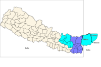
This area covers nine districts: Jhapa, Ilam, Panthar, Taplejung, Morang, Sunsari, Dhankuta, Terhthum and Sankhuwashava.
[citation needed] The land was sub-divided into three regions, namely, the Wallo, Majh and Pallo Kirat.
The ten rulers, their kingdoms and their forts: After a brief period, Limbu King Mawrong Hang came to prominence and took over Terai lands of Chethar, Bodhey, Panthar, and Ilam (present day Jhapa, Morang Sunsari and Dhankuta).
He died without any male heir and King Uba Hang took over as supreme ruler of Limbuwan in 849 AD- 865 AD.
Muda Hang was a weak ruler so the local chiefs started ruling their areas independently.
At the beginning of the 15th century, the descendants of King Sirijonga hang became weak and Limbuwan again fell into chaos and anarchy.
At the time, the two Yakthung Ing brothers from Kamrup Assam, had come and proclaimed the independent country of Phedap, Pokblabang and Bijayapur, Morang.
Some of the descendants of Yen Hang Mukpa Raya were not in favor of the treaty with Gorkha kings because they wanted to make their own territorial ruling system in great Yakthung Laje .
King Bijay Narayan Raya Sanlga Ing built a new town in the middle of Varatappa and Shangori fort and named it Bijaypur after him.
Bijaypur town remained the capital of Morang Kingdom and Limbuwan region until the Limbuwan-Gorkha War in 1774 AD.
The Madheshi settlers moved north and east from the Mithila region in the west, and thus also came during this time to cultivate the terai lands of Limbuwan.
[9] The arrival of the non-limbu settler was part of a policy instituted by Kathmandu encouraging the immigration of Hindus into Limbuwan.
Archival research for the period 1830 to 1917 reveals that the British administrators were conscious that the Limbus were indigenous to Sikkim.
[13] Following the end of Sikkim-Gorkha war at Limbuwan, the Gorkha officers started searching Limbus who had sided with the Sikkimese King or Sikkhim Kingdon.
Seeing this, all the Limbus who had fought against the Gorkhas by siding with the Sikkimese King, they assembled and decided to leave Limbuwan forever.