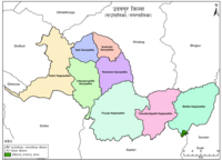
Triyuga Municipality
The total area of the municipality is 547.43 square kilometres (211.36 sq mi)[2] Almost all facilities are available in the town.
Triyuga municipality was established on 26 March 1997 merging 3 VDCs: e.g. Gaighat, Deuri and Bhumarashuwa.
[3] On 6 March 2017, following VDCs added into Triyuga municipality: Jogidaha, Saune, Khanbu and Jalpachilaune.
Gaighat (गाइघाट) (other name of Triyuga) is the shadow of a historic kingdom of Sen dynasty in Udayapurgadhi (Chaudandi), this Inner Terai Valley of south-eastern Nepal has a glorious history with a bright future.
The total population of the municipality, as of 2011 Nepal census is 87,557 in which male comprises 41,221 and female 46,336.
Rai 12.43%, Magar 9.04%, Bahun (Hill Brahman) 7.74% comprises total population of the municipality.
[5] The total population of Triyuga municipality in 2021 has been increased compared to 2011 Nepal census.
Nepali is the most spoken language in this municipality with 55.3%, Tharu is second with 14.6%, Maithili is third with 7% and Magar is at fourth with 6.5%.
Chamling, Tamang, Rai, Danuwar and Nepal bhasha are other minor languages that are also spoken in this municipality.
Triyuga Janata Multiple Campus provides undergraduate and post graduate education on management and social sciences.
Similarly Udayasi English higher secondary school provides intermediate education on science and management.
There are numerous other schools for education, such as: Tharuhat Rangsala Football, cricket and Cycling are the most popular sports in Gaighat.
The Sagarmatha Highway (NH-16) via Thadi Border, (Saptari) connects Gaighat to Bihar (India).
Mahendra Highway (NH-01) crosses NH-16 at Kadmah-Lahan (Saptari) which connects Gaighat with all other parts of the country.
Likewise Madan Bhandari Highway (NH-09) goes through the city which connects Dharan in the East and Sindhuli in the west.
Shree Airlines and Buddha Air operates daily flights between Rajbiraj and Kathmandu[8][9] The town in connected to Indian border via Thadi in Nepal and Laukaha in India which is 51 km South of Gaighat are a part of one of the agreed route for Mutual Trade between India and Nepal.
[11] and Government of India has set up a Land Customs Station with a Superintendent level officer.