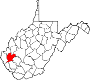
Lincoln County, West Virginia
[3] Lincoln County is part of the Huntington-Ashland, WV-KY-OH Metropolitan Statistical Area.
Jesse, John, David, William, and Moses McComas were the first Anglo settlers in what is now Lincoln County.
They cultivated 20 acres (81,000 m2) of corn, the first ever grown in the area near present-day West Hamlin, in 1799.
Their families were initially left behind because it was not known if there were any hostile Native Americans in the area, or if the soil would be suitable for cultivation.
About 1804, William Wirt Brumfield settled at the mouth of Big Ugly Creek.
Based on military enlistments, Lincoln County appears to have been evenly divided in its sympathies during the Civil War.
The county hosted a handful of small skirmishes, mostly centered on Mud River.
In 1863, West Virginia's counties were divided into civil townships, with the intention of encouraging local government.
This proved impractical in the heavily rural state, and in 1872 the townships were converted into magisterial districts.
[4] Between its formation in 1867 and 1870, Lincoln County was divided into seven townships: Carroll, Duval,[i] Harts Creek,[ii] Jefferson, Sheridan, Union, and Washington.
As of the 2010 United States census, there were 21,720 people, 8,783 households, and 6,268 families living in the county.
After they took a massive shift towards the GOP, the last Democratic candidate to carry Lincoln County was Al Gore in 2000.