Lismore, New South Wales
Use of the river for transport declined and then ceased around the mid-twentieth century, however by that time Lismore (which was elevated to city status in 1946) had become well established as the largest urban centre in the region, providing its surrounding area with a range of services.
The city is also located on the Bruxner Highway which crosses the Wilsons River at Lismore, and was formerly a stop on the Casino-Murwillumbah railway line.
[5] The chosen site was William Wilson's homestead paddock and the area was proclaimed the "Town of Lismore" in the NSW Government Gazette on 1 May 1856.
[9] From the 1840s onwards, timber cutters moved up the Richmond River from its Ballina entrance felling timber from the extensive, previously untouched subtropical rainforest covering the region known as the "Big Scrub"; their primary interest was the Australian red cedar, Toona ciliata, known locally as "red gold", which was highly prized for its appearance, ease of working, and pest resistance.
Despite its low-lying position and propensity for flooding (which was to cause problems in subsequent times), Lismore developed as an inland port owing to its location at the highest navigable point for large cargo-carrying vessels on the north arm of the Richmond, later renamed the Wilsons, River.
Infrastructure development in Lismore continued, including the presence of three schools by 1879, a new Government Wharf in 1880, two new bridges over the river in 1884 and 1885, the railway station (1894) and a new post office building (1898); by the end of that century Lismore had a population of over 4,500, although had suffered from some ravages including numerous floods plus a period of drought in the last half of the 1890s.
[citation needed] However, as the century progressed, development of a better road network and the advance of motor transportation made inroads into the long-term success of both the river and rail traffic which eventually declined: river traffic was also affected by requisitioning of ships during the second world war and the largest shipping line operating on the two arms of the Richmond River, the North Coast Steam Navigation Company, went into liquidation in 1954; the railway line lasted until 2004 when it was closed on purely economic grounds after advising that it was "unprofitable" to continue providing services to Murwillumbah, putting an end to 110 years of rail transport in the region.
[11] Meanwhile, economic development in Lismore continued, including construction of a new School of Arts (1907, destroyed by fire in 1932), building of churches for four denominations, opening of a new Norco (dairy farmers' cooperative) factory in 1931, and other utilities.
The network is considered to be in need of maintenance and work by most residents, due to high levels of crime and bad service outside of the city centre.
The 1960s were something of a boom time in development for Lismore, although the dairy industry was starting to decline and by the end of that decade and into the 1970s, many farmers turned to raising beef cattle instead, or simply let their land condition lapse.
[14] In addition, tourism has become an important contributor to the region's economy as well as the development of new agricultural products such as macadamias, avocado and stone fruit, pecans, and boutique coffee plantations, which are well suited to the rich volcanic soils, subtropical climate and moderately high rainfall of the area.
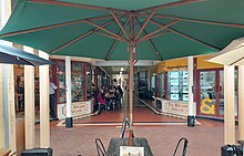
[18] The commercial city centre retains many shopfronts ranging in date from the late nineteenth to mid twentieth centuries with little modern intrusion; a feature of interest is the presence of numerous arcades, for example the 1920s Star Court Arcade, which includes the 1921 Star Court Theatre,[19] which allow shoppers to continue to shop in comfort in the presence of subtropical downpours as well as extremes of heat or cold.
[30] Lismore and surrounding towns were once part of the rainforest referred to as the "Big Scrub", of which less than one percent remains following British settlement.
A section of this rainforest is viewable in the grounds of the Southern Cross University and at Wilsons Nature Reserve on Wyrallah Road.
Although no other major environmental hazards generally affect the area, Lismore is renowned for frequent floods from Wilsons River and Leycester Creek.
[33] Nonetheless, around 3000 residents of Lismore were evacuated after floods affected much of the area on 30 June 2005,[34] many being temporarily housed on the campus of Southern Cross University.
However, the new levee that had been completed two weeks prior limited damage and stopped the water reaching the Central Business District.
In the aftermath of Cyclone Debbie in March 2017, Lismore was again badly affected by flooding of up to 3.5 metres (11 ft) through all CBD businesses.
[39] The Wilsons River in Lismore reached 14.37 metres at its peak, the largest flood since modern records began.
For example, the region experienced a significant reduction in rainfall between late 2002 and mid-2003 and again in 2007 in association with persistent and recurrent El Niño events.
The municipal water supply is provided by Rous County Council via Rocky Creek Dam, which is situated in a high rainfall area within the Whian Whian State Conservation Area approximately 20 km north of the city, and can be supplemented by drawing additional water from the Wilsons River when required.
[46] In a 2016 report prepared for Insurance Australia Group (IAG),[47] the consulting company SGS Economics and Planning rated and mapped different Local Government Areas (LGAs) across Australia against a range of natural hazard risks, namely Tropical Cyclone, Storm, Bushfire, Earthquake and Flood.
[53][54] The Northern Rivers Echo was a free weekly community newspaper for Lismore, Alstonville, Wollongbar, Ballina, Casino, Nimbin and Evans Head.
The first such relationship established between Australia and Japan, it was initiated by Lismore-born Marist priest and writer Paul Glynn.