Outline of the Cook Islands
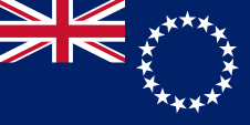
The following outline is provided as an overview of and topical guide to the Cook Islands: Cook Islands – self-governing parliamentary democracy in free association with New Zealand.
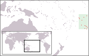
[1] The fifteen small islands in this South Pacific Ocean country have a total land area of 240 square kilometres (92.7 sq mi), but the Cook Islands Exclusive Economic Zone (EEZ) covers 1.8 million square kilometres (0.7 million sq mi) of ocean.
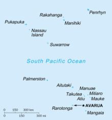
[2] The main population centres are on the island of Rarotonga (c.10,000), where there is an international airport.
Defence is the responsibility of New Zealand, in consultation with the Cook Islands and at its request.
In recent times, the Cook Islands have adopted an increasingly independent foreign policy.