Loring, Alaska
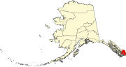
Loring is located at 55°36′11″N 131°38′13″W / 55.60306°N 131.63694°W / 55.60306; -131.63694, on the western shore of Revillagigedo Island, approximately 15 miles (24 km) north of Ketchikan as the crow flies.
It is located on the northern shore of Naha Bay, an arm of Behm Canal.
[6] This population figure also included adjacent native fishing camps.
Although the cannery and post office at Loring continued to operate until 1930 and 1936, respectively, it did not report on the census again from after 1900 until 110 years later, in 2010.
This article about a location in the Ketchikan Gateway Borough, Alaska is a stub.