River Derwent, Yorkshire
It flows from Fylingdales Moor in the North York Moors National Park, east then southwards as far as its confluence with the River Hertford then westwards through the Vale of Pickering, south through Kirkham Gorge and the Vale of York, joining the River Ouse at Barmby on the Marsh.
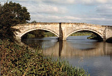
It covers an area of 2,057 square kilometres and includes the towns of Stamford Bridge, Malton, Pickering, Helmsley, Filey and Scarborough.
The river is used for water abstraction, leisure and sporting activities and effluent disposal, and also has several important nature reserves.
Water abstracted from the Derwent supplies towns and cities such as Hull, Leeds, York and Scarborough.
The river water is of generally good quality with BOD levels remaining below 2 mg/L all year round.
It is typical of northern British rivers in that it exhibits acid flushes at peak times of rainfall (during the winter months).
There are also several effluent sites scattered along this river at Malton, Stamford Bridge, Elvington, Wheldrake and Bubwith.
As of 2023 the River Derwent is only navigable by small powered craft between East Cottingwith Lock and Barmby Barrage.
Upstream of East Cottingwith/Thorganby are the remains of the stanchions of an old bridge which are a choke point for drifting fallen trees, which prevent access.
At its source on the North York Moors the River Derwent and its tributaries run over Corallian Limestone from the Jurassic period.
[2] Before the last ice age the waters of the upper Derwent flowed east and discharged into the sea at Scalby, near Scarborough.
As the ice melted the detritus was deposited to form the Wykeham moraine and permanently blocked the eastern exits of the watercourse.
The water cut a gorge through the Howardian Hills as it drained away southwards, breaching the Escrick moraine just east of Wheldrake, and joining the Humber glacial lake.
[2] Two of these units (Howe Bridge and Ness) relate to the River Rye which is the subject of a separate article.
[2] The River Hertford starts close to Hunmanby near the seaside town of Filey and flows westwards into the Derwent.
Having been joined by the River Hertford, the Derwent turns sharply west and flows along the Vale of Pickering past Yedingham village.
In the northern part of this area lies the North York Moors National Park, where the land is used mainly for upland grazing and forestry.
[2] After leaving Malton the river flows south through the steep-sided valley of Kirkham Gorge past Howsham Mill and weir to Buttercrambe.
[2] The river continues southwards, cutting through the slightly higher surrounds of the Escrick moraine and into the Vale of York and past Wheldrake.
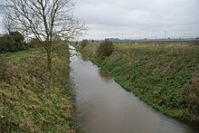
[2] At East Cottingwith the Derwent meanders across its flood plain still going south, and collects the waters of the Bielby Beck and the Pocklington Canal which form the major part of the catchment.
There are also hay meadows and pastures, known locally as Ings, which form part of the Lower Derwent Valley designated conservation sites.
Water from the tidal River Ouse is prevented from entering the Derwent by means of a barrage at Barmby on the Marsh.
[2][6] The main river, its tributaries and adjacent wetlands are significant for nature conservation, ecology and landscape.
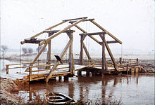
[8] During the reign of King John (1199–1216) a water mill on the Derwent at Wheldrake was given to the monks of Fountains Abbey, and later in the 13th century a weir is known to have existed at the same place.
The owners of land near the river complained in 1722 that the new locks and weirs caused them to lose income because their meadows were more often flooded.
In 1793 thirty-five vessels were trading from Malton, carrying corn downstream to the West Riding towns and returning upstream with coal.
In 1855 the railway managers bought the Navigation, and to further stifle competition they charged high tolls on barge freight.