Lower Mississippi River
The river is, however, constrained by levees and dikes to control flooding and secure a navigation channel for barges.
[4] The political and engineering focus in the 20th century was to separate the Lower Mississippi River from its floodplain.
Agricultural runoff has resulted in increased turbidity, siltation, pollution from pesticides, toxicity to aquatic organisms, oxygen depletion and eutrophication.
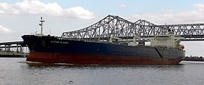
[5] Channel depth of 9 feet is maintained by the Corps of Engineers from St. Louis, Missouri to Baton Rouge, Louisiana.
[7] There is a feasibility study to dredge this portion of the river to 50 feet to allow New Panamax ship depths.


In late 2022, low water levels in the Lower Mississippi River caused two backups that held up over 100 tow boats with 2,000 barge units, causing barge rates to soar [ 9 ] [ 10 ]

Major flood stage
Moderate flood stage
Flood stage
Action stage
River levels
Minimum operating limit (-12 feet)