M-55 (Michigan highway)
The highway crosses through rural forest and farmlands to connect Manistee with Tawas City.
Running for 150.944 miles (242.921 km) through the state, M-55 is maintained by the Michigan Department of Transportation (MDOT).
The trunkline runs southeast on Caberfae Highway over the Manistee River and through the Peters and Highpoint bayous.
The highway passes near the community of Eastlake before turning eastward through forest land.
In eastern Manistee County, the roadway crosses the Pine River south of the Tippy Dam Pond in Wellston.
M-55 intersects M-37 in western Wexford County southwest of the Caberfae Peaks Ski & Golf Resort.
M-55 turns east again along Houghton Lake Road, separating from M-66 north of the central business district.
This section of trunkline passes through mixed farm and wood lands that transitions to mostly forests near Merritt.
[5] From the end of the freeway concurrency, M-55 follows Business Loop I-75 (BL I-75) into downtown West Branch.
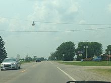
After leaving town, the highway runs through farm lands in rural Ogemaw and Iosco counties.
[8] A western extension was added from Cadillac to US 31 near Manistee in 1932 while the eastern end was shifted from Whittemore to Tawas City when US 23 was rerouted through the area.
In rerouting M-55, it was shifted back to its former routing through Houghton Lake Heights, replacing Bus.
[22][23] The last routing change was made in November 2000 when the southern segment of the Cadillac bypass was opened.