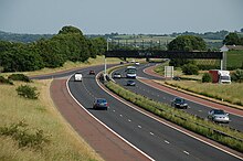
M1 motorway (Northern Ireland)
The road begins at the Broadway roundabout to the west of Windsor Park and running parallel to the Blackstaff River.
Now heading west past Aghnatrisk it runs parallel to and then crosses the Belfast-Dublin Railway Line followed by the River Lagan before reaching Moira.
Continuing west, it passes between Killaghy and Tullydagan and to the north of Lurgan and Turmoyra, across the Pound River, south of Lough Neagh, before its junction with the M12 at Craigavon.
It passes south of Derryadd Lough and runs in a loop around the Annagarriff Nature Reserve before crossing the River Blackwater, skirting to the north of Tamnamore and Laghey Corner before ending at Dungannon on the A4.
[dubious – discuss] The road was constructed in stages between 1962 and 1968:[3] Prior to the opening the RUC traffic division ran a publicity campaign to educate drivers on how to drive on a motorway.
[1] At the end of 1965 UK Transport Minister Tom Fraser and his successor Barbara Castle imposed a blanket 70 mph (113 km/h) speed limit on motorways in Great Britain, but the recently constructed Northern Ireland M1 remained free of a blanket speed limit for several years.
Some of these have now been used for other road plans: The M1 is straight and flat on the 6-mile (9.7 km) stretch between Junctions 9 and 10 and on the 4-mile (6.4 km) stretch between Junctions 12 and 13, and an urban myth exists claiming that these were to be used as supplementary runways by the United States Air Force in the event of a major conflict with the Soviet Union.
Work was also carried out on the A4 which begins at the terminus of the M1 between Dungannon and Ballygawley (approximately 12.5 miles (20.1 km)) was upgraded to dual carriageway standard,[7] opening in November 2010.