M8 motorway (Ireland)
On 28 May 2010, the motorway was completed and had replaced almost all of the single-carriageway N8 except for a short section of urban road in Cork City.
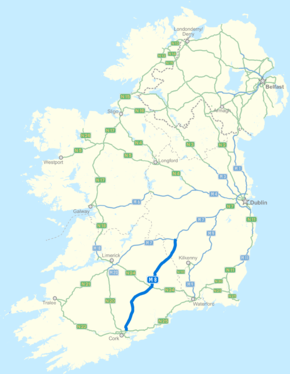
From here it proceeds southwards, passing under the R434 and R433 roads until it runs parallel to the single-carriageway R639 road, bypassing Abbeyleix, Durrow, Cullahill, Johnstown, Urlingford, Littleton, Horse and Jockey, Cashel, New Inn, Cahir, Skeheenarinky, Kilbeheny, Mitchelstown, Kilworth Mountain, Fermoy, Rathcormac, Watergrasshill and Glanmire.
South of Cashel, it enters the Golden Vale and crosses the River Suir west of Cahir.
The motorway then travels south-west along the Galtee Mountains, passing Glengarra Wood and Mitchelstown Cave.
Consequently, traffic volumes through Watergrasshill increased by about 6,000 vehicles (of which approximately 1,100 were lorries) per day at the end of that year.
[7] Other components of this plan, such as the N40 South Ring Road and the Jack Lynch Tunnel, were substantially delivered and operational by 1999.
[9] The Watergrasshill Bypass was the second section of grade separated dual carriageway to open on the Cork-Portlaoise route.
[10] Built by Mowlem and Bowen in partnership, the seven kilometre route replaced a winding and narrow section of the older N8 (now the R639) through Watergrasshill and Sallybrook villages.
[9] Construction of the €48 million 6.7 km Cashel bypass began in May 2003 and it opened to traffic in October 2004 with a speed limit of 100 km/h.
[11] Originally classified as a standard dual carriageway section of the then N8, the scheme was officially redesignated a motorway by Statutory Instrument on 17 July 2008.
The Cashel Bypass was built by Roadbridge Ltd. Construction of this 17.5 km tolled scheme started in June 2004 and was completed on 2 October 2006.
Construction of this 40 km stretch started in October 2006[17] and was opened to traffic on 8 December 2008, some seven months ahead of the target completion date.
[19] Like the Cashel-Cullahill project, the Fermoy-Mitchelstown scheme was redesignated a motorway during its construction, having originally been envisaged as a HQDC.
The contractor building the scheme was Portlaoise Joint Venture (PJV), which was acquired by BAM before the project's completion.
The scheme drew national attention during the preliminary archaeological investigations in January 2006 when over 500 human skeletons from the seventh century were discovered at the townland of Parknahown just south of Cullahill.