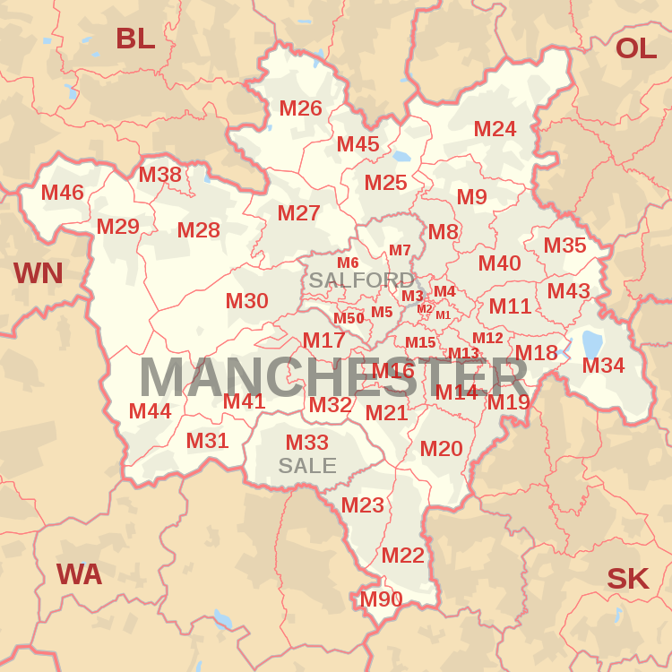
M postcode area
The districts are subdivisions of three post towns: Manchester, Salford and Sale and cover parts of all ten boroughs of Greater Manchester, primarily the cities of Manchester and Salford and the majority of the borough of Trafford.
[5] Before the introduction of postcodes in the 1960s, Manchester along with other major cities like Birmingham, Liverpool and Sheffield was divided into numbered postcode districts.
With a few exceptions these numbers made up the outcode (the first part of the postcode).
For example, the City Centre had postcode districts 1–4 (north-east, south, west and north-west respectively: Manchester 1 was around Piccadilly and 4 was around Victoria).
5, 6, 7 and 8 were in Salford and then the sequence continued across north Manchester and so round to M17 (Trafford Park).