Macal River
[2] For the lower Macal River catchment (or Mountain Pine Ridge area), tributary streams are arranged radially to feed the mainstem; principal lower basin rivers are the Privassion, Rio On, Rio Frio, Mollejon, Chaa Creek and Cacao Camp.
The retarded runoff of this lower sub-watershed allows the rapid peak runoff of the upper watershed to overtake the flow within Mountain Pine Ridge, forming an effective single massive peak wave, which exacerbates downstream flooding in the Belize River, and, in fact, controls the flood stage of the larger Belize River.
Considerable biodiversity is found within the Macal River catchment basin, including megafauna, avafauna, fish, reptiles, amphibians, as well as smaller mammals, arthropods and plants.
Raptors hunt among the valleys of Mountain Pine Ridge, and affords the most probable location in Belize to observe the orange-breasted falcon.
[5] The Chalillo Hydroelectric Dam was completed on the river in 2005 by Fortis Inc., the Canadian owner of the national electrical utility, about 33 km (21 mi) south of San Ignacio, Belize.
The Mayan urban society collapsed in this watershed in the ninth century AD, likely related to the exhaustion of agricultural resources, or reaching of the limited carrying capacity of this region of nutrient poor soils, with possible aggravation of social factors.
Whilst the highest reaches of the watershed are only accessible to the most hardy of hikers, the Mountain Pine Ridge area is available to travellers by auto (not bus).
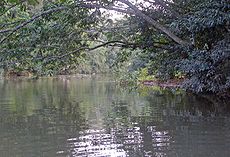
In the lowest reach there are a number of jungle resorts which offer access to the banks of the Macal for flotation or canoe trips to San Ignacio.