Madanpur, India
[1] In the middle of the eighteenth century when the railways were yet to come to Bengal, the present day area of Madanpur (situated on the bank of river Ganges) was full of grassland.
The origins of the name 'Madanpur' maybe traced to a popular myth in which Thakur Madangopal who accompanied with Sri Radha took rest at this place on their way to Krishnanagar.
[2] According to the map of Chakdaha CD block, in the District Census Handbook 2011, Nadia, Chanduria, Priyanagar, Shimurali, Jangal, Madanpur, Saguna and Kulia form a cluster of census towns between Chakdaha and Kalyani/ Gayespur.
[3] Nadia district is part of the large alluvial plain formed by the Ganges-Bhagirathi system.
It is spread till Kaliganj in the North, Ishwaripur in the West, Birohi in the East and Kalyani in the South.
Yamuna river, a feeder of Ganges flows through Madanpur to meet Ichhamoti.
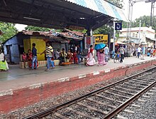
[8] According to the District Census Handbook 2011, Nadia, Madanpur covered an area of 3.3 km2.
Among the civic amenities, the protected water supply involved overhead tank, tubewell/ borewell, hand pump.
[9] There are nationalized banks, cooperatives and micro-financing institutions supporting the agrarian economy of the region.