Makgadikgadi Pan
The pan is all that remains of the formerly enormous Lake Makgadikgadi, which once covered an area larger than Switzerland, but dried up tens of thousands of years ago.
Recent studies of human mitochondrial DNA suggest that modern Homo sapiens first began to evolve in this region some 200,000 years ago, when it was a vast, exceptionally fertile area of lakes, rivers, marshes, woodlands and grasslands especially favorable for habitation by evolving hominins and other mammals.
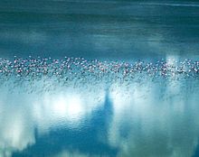
A dry, salty, clay crust most of the year, the pans are seasonally covered with water and grass, and are then a refuge for birds and animals in this very arid part of the world.
[2] These salt pans cover 6,200 sq mi (16,057.9 km2) in the Kalahari Basin and form the bed of the ancient Lake Makgadikgadi, which evaporated many millennia ago.
[5] As the ancestral Lake Makgadikgadi shrank, it left relic shorelines, which are most evident in the southwestern part of the basin.
[8] Kubu Island lies in the southwestern quadrant of Sua Pan, contains a number of baobab trees, and is protected as a national monument.
[10] Very little wildlife can exist here during the harsh dry season of strong hot winds and only salt water, but following a rain the pan becomes an important habitat for migrating animals including wildebeest and one of Africa's biggest zebra populations, and the large predators that prey on them.
In Nxai Pan the baobabs painted by 19th century British artist Thomas Baines are still visible.