Mangalore
Mangalore (/ˈmæŋɡəlɔːr, ˌmæŋɡəˈlɔːr/ MANG-gə-lor, -LOR), officially known as Mangaluru (Kannada: [mɐŋɡɐɭuːru]), is a major industrial port city in the Indian state of Karnataka and on the west coast of India.
Mangalore remained part of the Madras Presidency until India's independence in 1947 and was unified with Mysore State (now called Karnataka) in 1956.
The Dakshina Kannada district with its administrative headquarters at Mangalore has the highest Per Capita Income and Gross State Domestic Product in Karnataka, after Bangalore.
[10] According to local legend, a princess named Parimala or Premaladevi from Malabar[11] renounced her kingdom and became a disciple of Matsyendranath, the founder of the Nath tradition.
[20] In Tulu, which is the region's primary spoken language, the city is called Kudla, meaning junction because it is situated at the confluence of the Netravati and Gurupura rivers.
[41] During the 1130s and 1140s, during the reign of the Alupa king Kavi Alupendra (1110–1160), the city was home to the Tunisian Jewish merchant Abraham Ben Yiju.
[38]: 19 In 1448 Abdur Razzaq who was the Persian ambassador of Sultan Shah Rukh of Samarkand, visited Mangalore en route to the Vijayanagara court.
[46][44]: 31 The Italian traveller Ludovico di Varthema, who visited India in 1506, said he saw nearly sixty ships laden with rice ready to sail from the port of Mangalore.
[38]: 20 In 1498, European influence in Mangalore began when the Portuguese explorer Vasco da Gama landed at the nearby St Mary's Islands, just after his arrival at Koyilandy, Kozhikode.
[38] In 1524, Vasco da Gama ordered the blockading of rivers after he heard the Muslim merchants of Kozhikode had agents at Mangalore and Basrur.
It is written in Arabic and contains pieces of information about the resistance put up by the navy of Kunjali Marakkar alongside the Zamorin of Calicut from 1498 to 1583 against Portuguese attempts to colonize Tulu Nadu and Malabar coast.
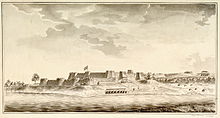
Mangalore was ruled by the British East India Company from 1767 to 1783,[60] but Hyder Ali's son Tipu Sultan took it from their control in 1783 and renamed it "Jalalabad".
[38] Local capital was mainly invested in land and money lending, leading to the regional development of banking because the British colonial government did not support industrialisation there.
[70]: 6 On 23 May 1866, a municipal council for Mangalore with responsibility for civic amenities and urban planning was mandated by the Madras Town Improvement Act (1865).
[71] Mangalore was linked to the Southern Railway in 1907 and the subsequent proliferation of motor vehicles in India further increased trade and communication between the city and the rest of the country.
[83] The city's topography consists of a plain that stretches up to 30 km (18.64 mi) from the coast and undulating, hilly terrain towards the east near the Western Ghats.
[82] The Geological Survey of India has identified Mangalore as a moderately earthquake-prone urban centre and categorised the city in the Seismic III Zone.
[93] The summer gives way to the monsoon season, when the city experiences the highest precipitation of all urban centres in India due to the influence of the Western Ghats.
[102] The Dakshina Kannada district with its administrative headquarters at Mangalore has the highest Per Capita Income and Gross State Domestic Product in Karnataka, after Bangalore.
[105] Dakshina Kannada district has the highest percentage of workers employed in industry and the second-highest industry-to-district GDP ratio in Karnataka.
[116] The Indian government has built 5.33 million tons of strategic crude oil storage at Mangalore and Padur to ensure energy security.
[6] Hinduism is the largest religion in Mangalore, and Devadiga, Mogaveera, Billavas, Ganigas, Bunts, Vishwakarma, Padmashali, Brahmins, and Daivadnyas are the major communities among Hindus.
[3] Municipal limits begin at Surathkal in the north, Netravati River bridge in the south, the western coast, and Vamanjoor in the east.
[194][195] Potable water is supplied to the city from a vented dam that was constructed across the Netravati River at Thumbe, 14 km (9 mi) from Mangalore.
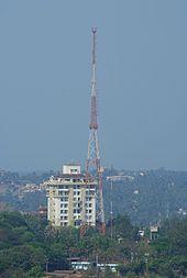
[204] Prominent broadband internet service providers in the city include Airtel and DataOne by Bharat Sanchar Nigam Limited.
[269] Paddanas, ballad-like epics passed on verbally through generations, are sung by a community of impersonators in Tulu and are usually accompanied by the rhythmic drum beats.
[271][272] Kodial Theru, also known as Mangaluru Rathotsava (chariot festival) is unique to the Goud Saraswat Brahmin community and is celebrated at the city's Sri Venkatramana Temple.
[288] Well-known Mangalorean dishes include kori rotti, neer dosa, pundi (rice ball), patrode, golibaje and Mangalore buns.
[303] Major national English-language newspapers such as Times of India, The Hindu, The New Indian Express, Deccan Herald and Daijiworld[304][305] publish localised Mangalore editions.
[340] Schools and colleges from across Dakshina Kannada, Udupi and Kodagu districts participate and the matches are conducted under seven categories for children and young adults in education.