Mangrove deforestation in Myanmar
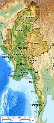
Mangrove deforestation in Myanmar is usually for commercial uses or resources extraction, and is occurring mainly in 3 different regions: Rakhine State, Ayeyarwady Mega Delta, and Tanintharyi Division.
Mangrove forests also help ameliorate negative impacts from natural disasters and are home to many different types of flora and fauna that thrive specifically in these ecosystems.
Mangroves used to be more common but currently mainly grow in 3 different regions: Rakhine State, Ayeyarwaddy Mega Delta, and Tanintharyi Division.
[4] Large areas of mangrove forests are cleared to plant rice fields, expand aquaculture, or to collect palm oil.
Natural threats to mangrove forests include erosion, land loss, inundation, sea flooding, upstream movement of the saline/freshwater front, and seawater intrusion into freshwater lenses.
[1] Mangrove forests play a major role in Myanmar’s economy since it provides natural resources for both personal and commercial uses.
Poorer rural communities that have settled near the mangrove regions are particularly dependent on these ecosystems for resources and sources of income.
Research shows that if there were less deforestation of mangroves, the death toll would have been lower when Cyclone Nargis hit Myanmar in 2008.
The law does not clearly address specific measures that are required to prevent illegal logging, encroachment, extraction of forest products and wildlife poaching in the protected areas.
In order to restore deforested areas, detailed planning is needed to enrich the soils and remove toxic material.