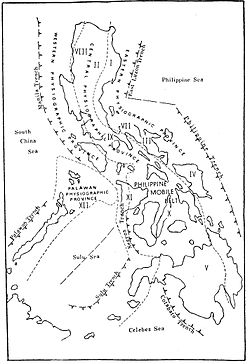
Manila Trench
The convergent boundary is terminated to the north by the Taiwan collision zone, and to the south by the Mindoro terrane (Sulu-Palawan block colliding with SW Luzon).
[9] The Manila Trench is associated with frequent earthquakes, and the subduction zone is responsible for the belt of volcanoes on the west side of the Philippine island of Luzon, which includes Mount Pinatubo.
Convergence between the Philippine Mobile Belt and the Sunda Plate have been estimated using GPS measurements, and this value ranges from ~ 50+ mm/yr in Taiwan, to 100 mm/yr near N. Luzon, and ~ 50 mm/yr near Zambales and ~20+mm/yr near Mindoro island.
This region is characterized by low free-air gravity anomaly, bathymetric depression, and a change of convex to concave trench axis geometry (which is a feature unique to this location).
Well-developed back-thrust faults, microfractures and gravitational collapse are found in the accretionary wedge of the Manila Trench.
The trench-fill sediments are thought to be sourced from the collisional zone of the Taiwan orogeny or by gravity controlled processes.
This zone has thought to have been formed by the bending of the lithosphere resulting from subduction processes (causing gravity sliding and faulting).
These blind thrust faults present potential danger as they are likely candidates for the causes of high-magnitude earthquakes, and in effect large-scale tsunamis.
This massive earthquake, which would be the 2nd strongest in recent history, would have a total length of 990 km and a maximum wave height of 9.3 metres.