Manipur
Covering an area of 8,621 square miles (22,330 km²), the state consists mostly of hilly terrain with the 700-square-mile Imphal Valley inhabited by the Meitei (Manipuri) community, historically a kingdom.
[12] In September 1949, the ruler of Manipur signed a merger agreement with India, giving up his kingdom and obtaining a privy purse in return.
[26] A 14th-century inscription from Pagan, Myanmar, mentions Kasan (Manipur) as one of the 21 states under the Mong Mao ruler Thonganbwa (1413–1445/6); he later was captured by the Governor of Taungdwingyi.
[51][52] Eventually Manipur was turned into a centrally administered province (called a 'Part C' state, later renamed union territory) by asking the Maharaja to sign a merger agreement.
[67][68] Its first armed opposition group, the United National Liberation Front (UNLF), was founded in 1964 aiming to achieve independence from India and establish Manipur as a new country.
This term (designated by the Ministry of Home Affairs or a state governor) refers to a territory where extraordinary laws under the Armed Forces (Special Powers) Act can be used.
[70] Since 1980, the application of AFSPA has been at the heart of concerns about human rights violations in the region, such as arbitrary killings, torture, cruel, inhuman and degrading treatment, and forced disappearances.
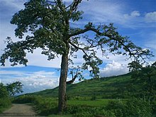
The capital lies in an oval-shaped valley of approximately 700 sq mi (2,000 km2), surrounded by blue mountains, at an elevation of 790 m (2,590 ft) above sea level.
The mountain ranges create a moderate climate, preventing the cold winds from the north from reaching the valley and barring cyclonic storms.
Rainfall in this region is caused by The South Westerly Monsoon picking up moisture from the Bay of Bengal and heading towards the Eastern Himalaya ranges.
A copper plate excavated from Phayeng dating back to 763 CE (believed to be of the reign of Meitei King Khongtekcha) was found to contain inscriptions about the Hindu deities in Sanskrit words.
[111] The Vishnu temple at Lamangdong was constructed during 1474 CE (during the reign of Meitei King Kiyamba), by Brahmins immigrating from the neighborhood Shan State.
They belong to the Sunni group of the Hanafi school of Islamic thought and they include Arabs, Bangladeshis, Turanis, Bengalis and Chaghtai Turks.
[121] The Nagas wish to annex part of Manipur and merge with a greater Nagaland or Nagalim, which is in conflict with Meitei insurgent demands for the integrity of their vision of an independent state.
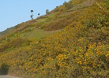
[126] Some cash crops suited for Manipur include Lychee, Cashew, Walnut, Orange, Lemon, Pineapple, Papaya, Passion Fruit, Peach, Pear and Plum.
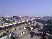
[18] National Highway NH-39 links Manipur with the rest of the country through the railway stations at Dimapur in Nagaland at a distance of 215 km (134 mi) from Imphal.
The seasonal Shirui Lily plant at Ukhrul (district), Dzüko Valley at Senapati, Sangai (Brow antlered deer) and the floating islands at Loktak Lake are among the rarities of the area.
The Keibul Lamjao National Park (KLNP), which is the world's only floating national park, located in the Loktak lake,[134][135] is under the tentative lists of the UNESCO World Heritage Sites, under the title "Keibul Lamjao Conservation Area (KLCA)", additionally covering the buffer of Loktak Lake (140 sq km) and Pumlen Pat (43 sq.
Kangla Fort, Marjing Polo Statue, Sanamahi Kiyong, Ima Market, Samban-Lei Sekpil, Shree Govindajee Temple, Andro village, and Manipur State Museum are in the city.
[citation needed] Keibul Lamjao National Park, 48 km (30 mi) away from Imphal is an abode of the rare and endangered species of brow antlered deer.
[143][citation needed] Six km (3.7 mi) to the west of Imphal, at the foot of the pine growing hillocks at Iroisemba on the Imphal-Kangchup Road are the Zoological Gardens.
Sadu Chiru waterfall is near Ichum Keirap village[144] 27 km (17 mi) from Imphal, in the Sadar hill area, Senapati district.
It is performed in an area of 13×13 ft in the centre of any open space, in a very simple style without a raised stage, set design, or heavy props such as curtains, background scenery, and visual effects.
[citation needed] Iskcon led by Bhaktisvarupa Damodara Swami started a network of schools in Northeastern India, where more than 4,000 students receive education centred on Vaishnava spiritual values.
Ranganiketan (literally "House of Colorful Arts") is a group of more than 20 dancers, musicians, singers, martial artists, choreographers, and craft artisans.
Chakravyuha deals with the story of Abhimanyu (son of Arjun) of his last battle and approaching death, whereas Uttarpriyadashi is an 80-minute exposition of Emperor Ashoka's redemption.
In Manipur's long history, Yubi lakpi was the annual official game, attended by the king, over the Hindu festival of Shree Govindajee.
[162][163] Captain Robert Stewart and Lieutenant Joseph Sherer[164] of the British colonial era first watched locals play a rules-based pulu or sagolkangjei (literally, horse and stick) game in 1859.
Held on 9 November,[170] this is a social festival of the Meitei people of Manipur where married women (Ningol) are invited (Chakouba, literally calling to a meal; for dinner or lunch) to a feast at their parental house accompanied by their children.
People of Manipur immaculate and decorate their houses and make a sumptuous variety of dishes to feast upon after offering food to the deity on this day.