Maryland Route 210
MD 210 is a four- to six-lane divided highway that connects Washington, D.C., with the suburban communities of Oxon Hill, Fort Washington, and Accokeek in southwestern Prince George's County, and Bryans Road and Indian Head in northwestern Charles County.
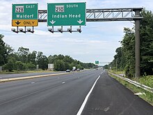
The highway also provides access to Fort Washington Park and Indian Head Naval Surface Warfare Center and, in conjunction with MD 228, connects Waldorf with Interstate 95 (I-95)/I-495 and I-295.
The previous highway between Washington, D.C., and Indian Head was Livingston Road, which was traced in the late 18th century and improved in the 1920s and early 1930s as MD 224.
Indian Head Highway was fully designated MD 210 in the mid-1950s when the road was transferred from federal to state control.
MD 210 was expanded to a divided highway in Forest Heights in the late 1940s and south through Fort Washington in the 1960s.
The state highway leaves the town and enters Potomac Heights, where it meets the western end of MD 225 (Hawthorne Road).
MD 210 leaves the populated area and passes to the south of Chapman State Park, which contains the historic farm complex Mount Aventine.
The state highway becomes undivided just south of its terminus at the District of Columbia boundary at Southern Avenue.
[4] The main highway along the Washington–Indian Head corridor before the construction of Indian Head Highway was Livingston Road, which follows much of the course of a road that has connected Charles County and the District of Columbia parallel to the eastern shore of the Potomac River through Prince George's County since the late 18th century.
The road became more important as the highway connecting Washington, D.C., with both Fort Washington and Fort Foote and later the Indian Head Naval Proving Ground, a gunpowder factory and testing area started by the U.S. Navy in the late 19th century.
[6] At the District of Columbia boundary in what is now Forest Heights, Livingston Road continued north to Atlantic Street, which connected with Nichols Avenue (now Martin Luther King Jr. Avenue), which headed north to a crossing of the Anacostia River at the site of the 11th Street Bridges.
[14] The need for upgrades to Livingston Road became acute by 1940 with the greatly increased activity at Fort Washington and the Indian Head Naval Powder Factory in the years before the United States entered World War II.
[23] That same year, the Livingston Road portion of MD 224 from Mason Springs to Washington was transferred to county maintenance.
[27] MD 210 was made a divided highway from Oxon Hill south to near Fort Foote Road in 1965.
[36][37][38] In 2004, MD 210 achieved its present southern terminus at Potomac Avenue when the highway from there west to the military reservation gate was transferred to the town of Indian Head.
[39] MD 210 was reconstructed in Forest Heights starting in 2006 in work related to the construction of the new Woodrow Wilson Bridge.
In addition, the intersection with Wilson Bridge Drive north of Kerby Hill Road was closed and replaced with a right-in/right-out interchange with southbound MD 210.