Maryland Route 4
MD 4 also connects Calvert and St. Mary's counties via the Governor Thomas Johnson Bridge across the Patuxent River.
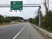
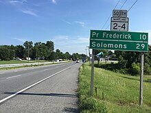
The highway connects the Southern Maryland county seats of Leonardtown, Prince Frederick, and Upper Marlboro.
After the Governor Thomas Johnson Bridge opened in the late 1970s, MD 4 was extended west from Solomons to Leonardtown.
MD 4 has been upgraded to a divided highway for most of its length, beginning in the early 1960s from Washington, reaching Solomons in the mid-1980s, and expected to continue into St. Mary's County in the future.
From Bristol to MD 717 in Upper Marlboro, the route is named Stephanie Roper Highway.
The Roper name was added to the highway by an October 23, 2012, proclamation by then-Governor Martin O'Malley.
Another section of MD 765, Saw Mill Road, parallels the divided highway between Calvert Cliffs Parkway, which leads to the power station, and Flag Pond Parkway, which leads to Flag Ponds Nature Park.
The highway intersects Western Shores Boulevard, which provide access to Long Beach, respectively.
The routes leave Prince Frederick after their junction with MD 402 (Dares Beach Road) and the roadway reduces to four lanes before passing west of Calvert Health Medical Center.
A park and ride lot is located southwest of the intersection with the southern terminus of MD 524.
A park and ride lot serving MTA Maryland commuter buses is located east of MD 4 north of the Lower Pindell Road intersection, with access from MD 980B service road.
The southbound side is paralleled by another segment of MD 980 (MD 4 Service Road); there are ramps and right-in/right-out intersections with the parallel service roads on either side of Galloway Creek east of Jug Bay Wetlands Sanctuary.
MD 4 has a cloverleaf interchange with U.S. Route 301 (Robert Crain Highway) and crosses over CSX's Pope's Creek Subdivision rail line.
The freeway continues to the south of the town of Upper Marlboro, which is accessed via MD 4's diamond interchange with MD 717 (Water Street), which heads north toward the Prince George's County courthouse and county offices in the center of town and the Prince George's Equestrian Center and Show Place Arena to the south.
The highway heads northwest along the northeastern edge of the Andrews Air Force Base to an intersection with Suitland Parkway, which provides access to the military installation and leads west to MD 337 (Allentown Road).
North of the parkway, MD 4 drops to four lanes at its cloverleaf interchange with I-95/I-495 (Capital Beltway) in Forestville.
[1][2] MD 4 in Prince George's County was originally the Washington and Marlborough Turnpike, which exited the District of Columbia on Bowen Road, headed east to Forestville, south to Meadows, then east through Upper Marlboro to Hills Bridge on the Patuxent River.
[10][11][12] Pennsylvania Avenue was extended east out of D.C. to Dower House Road as a controlled access four-lane divided highway in 1959 and 1960 and was designated MD 4.
[16] The next major change in the routing of MD 4 came in 1977, when the Governor Thomas Johnson Bridge was completed.
[25] In 2018, construction began on the second phase of widening between north of the MD 231 intersection and Fox Run Boulevard.
[27] Another future project along MD 4 involves upgrading the highway between MD 223 in Melwood and the Capital Beltway in Forestville to a freeway featuring interchanges at the Suitland Parkway, Dower House Road, and Westphalia Road.