Maryland Route 5
From here, MD 5 continues north on Branch Avenue, running through suburban areas, before becoming a freeway as it passes Andrews Air Force Base and has an interchange with Interstate 95 (I-95)/I-495 (Capital Beltway).
Past the Capital Beltway, the route runs through suburban areas of Hillcrest Heights and Suitland before reaching the Washington, D.C. border, where Branch Avenue SE continues, crossing Pennsylvania Avenue SE and eventually terminating at Randle Circle.
The route was realigned to follow Naylor Road to the Washington, D.C. line in 1939, while MD 637 was designated along the portion of Branch Avenue leading to the border.
In 2007, a four-lane, divided bypass of Hughesville was completed, alleviating the traffic bottleneck within that town at the intersection of MD 231.
MD 5 begins within Point Lookout State Park in St. Mary's County by heading west on Point Lookout Road, a two-lane undivided road which continues south from the route’s southern terminus along the shoreline of the Chesapeake Bay to the confluence with the Potomac River.
The route turns north, passing a fee booth for the park at the entrance before continuing into wooded areas.
A short distance later, the road makes a left turn and heads northwest through a mix of woodland and farmland.
The road widens to four lanes and heads through a mix of residences and businesses, passing near MedStar St. Mary's Hospital.
[2] From here, the median narrows again as the route turns to the north and continues through a mix of farms and woods with some businesses, passing to the east of the St. Mary's County Welcome Center.
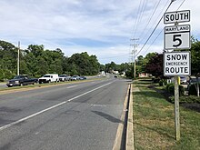
[3] MD 5 crosses into Charles County, where it continues north on Leonardtown Road through areas of rural residences.
[1][2] The road turns to the northwest past Bryantown and heads through wooded areas, passing through Zekiah Swamp.
[1][2] MD 5 follows Mattawoman Beantown Road, a four-lane divided highway that bypasses the center of Waldorf to the east.
[1][2] Mattawoman Beantown Road carries MD 5 north through farm fields before heading into woodland, passing west of a park and ride lot serving MTA Maryland commuter buses.
It continues into suburban residential areas of Waldorf, passing by the entrance to the Pinefield neighborhood, which used to be intertwined with several Nike Missile installations.
[2] The route crosses CSX's Popes Creek Subdivision railroad line at-grade before coming to an intersection with US 301 (Crain Highway).
[1][2] The Crain Highway crosses the Mattawoman Creek into Prince George's County, where it heads north through wooded areas with some businesses along the road.
[1][2] It continues north as a four-lane divided highway through woodland with some businesses and adjacent residential areas before passing by the MedStar Southern Maryland Hospital Center at the Surratts Road intersection.
[1][2] The route has a southbound exit to Old Branch Avenue and a northbound entrance from Old Alexandria Ferry Road before it turns north and heads through wooded surroundings, forming the western boundary of Andrews Air Force Base.
The route continues northwest into commercial areas, coming to a southbound left exit and left entrance with Woods Way that serves Branch Avenue station before it becomes a surface road again and intersects MD 967C (Simpson Road)/Auth Way and MD 967A (Old Branch Avenue).
The route narrows to four lanes and turns west, coming to an interchange with MD 414 (St. Barnabas Road) in Marlow Heights.
At this time, the road between Point Lookout and Leonardtown, Mechanicsville and Beantown, and the Charles-Prince George's county border and TB were proposed as state highways.
[6] MD 5 was designated in 1927 to the state highway between north of Point Lookout and the Washington, D.C. border, passing through Leonardtown, Hughesville, and Waldorf.
[14][15] In addition, the route was widened into a divided highway along the US 301 concurrency between the Charles-Prince George's county border and TB and along Branch Avenue between south of the Henson Creek and the Washington, D.C.
The same year, the portion of route along the US 301 concurrency between Waldorf and the Charles-Prince George's county border was widened into a divided highway.
[15] In 1967, the route was widened into a divided highway between the St. Mary's-Charles county border and MD 488 with the exception of the portion through Hughesville.
[39] Construction of Phase 1, which widened MD 5 to 6 lanes in the vicinity of the interchange, began in November 2009 and was completed in August 2011.
[42] In addition, the route is planned to be upgraded to a full freeway between US 301 and the Capital Beltway, with new interchanges at Burch Hill Road/Earnshaw Drive and Surratts Road.
The route headed west from MD 5 on Fenwick Street, a two-lane undivided road with a traffic count of 7,271 vehicles in 2007.
Past this intersection, the route passes more businesses before narrowing to two lanes and ending at MD 5 north of Hughesville.
The route heads west from MD 5 (Mattawoman Beantown Road) and St. Charles Parkway as a four-lane divided highway with a traffic count of 29,430 vehicles in 2007.