Mattole River
Communities, from north to south, closely associated with the Mattole River include: Petrolia, Honeydew, Ettersburg, Thorn Junction, and Whitethorn.
[4] During the Bald Hills War, this tribe mustered its warriors but it was outgunned and practically exterminated because of its resistance to white settlers.
[2] The river and its 74 tributaries drain about 304 square miles (790 km2), including the eastern side of the King Range, and flows through Mattole Valley before emptying into the Pacific Ocean.
[7] Areas in the Mattole River watershed are being restored to revive habitat that was degraded by a combination of early industrial-style timber harvest techniques and associated road construction, naturally erosive geology, and damage by two 100-year floods, which occurred in 1955 and 1964.
[12] Recently the group planned a pilot project to decrease winter runoff and increase summer flows, by using a model of beaver dams and pools.
Research done by an ecosystem analyst from the Northwest Fisheries Science Center of NOAA Fisheries shows that salmon smolt production per beaver dam ranges from 527 to 1,174 fish, whereas production in a pool formed by large woody debris is only 6 to 15 fish.
[13] This suggests that re-establishment of beaver populations would be 80 times more effective in salmonid recovery efforts than placement along of large woody debris.
[15] The common plant associations within the Mattole include the following: (1) coast redwood forest (in the southern headwaters), (2) mixed coast Douglas-fir and hardwood primarily tanoak and Pacific madrone forest, (3) mixed chaparral, primarily manzanita, mountain whitethorn, California scrub oak, and coyote brush, and (4) grasslands.
Riparian zones of the Mattole also support bigleaf maple, red alder, Fremont cottonwood, Oregon ash, and willow.
This would inhibit contraction of disease and decrease the native Mattole tradition of relying on river resources.
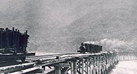
[17] Post World War II: Logging of Douglas fir became an increased practice for this period of building construction and the tax value of standing trees rose as well.
The best spawning habitat areas for salmonid species were damaged in 1970 when the chain development of residential housing began.
[citation needed] As a result, the developments caused the transportation of sediment to slow and eventually fill great spawning habitat stream channels.
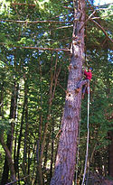
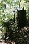
[19] They began incubating salmon eggs, clearing logjams and obstacles for fish migration and plant trees to sustain the riverbanks.
Its concepts encouraged residents to fight for fine timber, abundant fish, productive grasslands, and rich and varied plant and animal communities.
Of the structures, six created wide scour pools from 3 to 6 feet deep, with shade from overhead riparian vegetation.
[20] In 1997, timber harvesting limited the ancient pacific tailed frogs in the headwater channels causing the species became endangered.
[20] The pacific tailed frogs are also endangered, because they have morphological adaptations and biophysical constraints with temperatures so they are ecologically dependent.