May 2022 Canadian derecho
Described by meteorologists as a historic derecho and one of the most impactful thunderstorms in Canadian history,[6][7] winds up to 190 km/h (120 mph) as well as around four tornadoes caused widespread and extensive damage along a path that extended for 1,000 kilometres (620 mi).
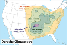
The historic range has likely shifted northward, due to climate change[11] Typically, derechos anywhere in this area can form from late spring through the summer months.
[14][15] A persistent May heat wave in the U.S. expanded sporadically to include southern Ontario and Quebec throughout May, resulting in unseasonably warm temperatures more typical of July.
[19] A sharp cold front was expected to bring thunderstorms through the region on Saturday, prior to a precipitous drop in temperature potentially resulting in subsequent frost.
[23] On Saturday morning at 10:37 am EST, thunderstorms with significant wind developed in Macomb and St. Clair counties in Michigan.
The wind of these storms snapped some trees, mostly in St. Clair County, but this cluster of thunderstorms had not yet formed a bow echo.
By 10:45 am when the storms hit London, the derecho had coalesced into a bow front roughly 100 km (62 mi) wide[25] and had developed wind speeds of close to 100 km/h (62 mph).
[27] The bow echo retained its structure for nine hours, and covered a total track length of 1,000 km (620 mi).
[29][30][31] Most of the weather stations along the derecho's path recorded wind gusts near or above 100 km/h (62 mph), including the Greater Toronto Area, Ottawa, Trois-Rivières, and Quebec City.
[32] A storm survey from the Northern Tornadoes Project reported a severe downburst in parts of southern Ottawa.
[45] This was the first time Environment and Climate Change Canada (ECCC) issued an Alert Ready message for a Severe Thunderstorm Warning.
[6] Strong winds downed over 1,900 hydro poles, five metal transmission towers, and numerous trees along the path of the derecho.
[54] The communities of Stittsville, Hunt Club, Navan, and Sarsfield, where a church steeple was toppled and farms were destroyed, were the worst hit in the Ottawa area.
Trains along the Windsor-Ottawa corridor were delayed by hours due to trees on the tracks, with some passengers having to be bussed to their destinations.
[68] Due to the extensive infrastructure damage and large number of fallen trees, at least a quarter of outages in the hardest hit areas continued more than four days.
[71] Some rural and remote Hydro One customers in the Perth, Bancroft, and Tweed areas remained without power for multiple weeks.
Red pine logs resulting from the fallen trees could be salvaged at no cost by the public, requiring only a land access permit.
[78] I don’t think our contingency plans have ever gone to the extent of massively losing power for a considerable number of days in a wide swath of returning offices.
Advance poll voting for the 2022 Ontario provincial election was disrupted by the power outages and by falling trees, particularly in the London, Kitchener-Waterloo, Brampton, Peterborough, and Ottawa regions.
Forty-nine advance polls closed after they lost power or were damaged by falling trees or wires, either temporarily or for the day.