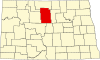
McHenry County, North Dakota
[2] McHenry County is part of the Minot, ND Micropolitan Statistical Area.
It was named for James McHenry, an early settler of Vermillion (in present South Dakota).
In 1886 the designation was again moved, to Towner, which has remained the seat to the present time (the two former sites are now ghost towns).
[4] The Souris River loops through the county before turning north to its eventual discharge into Lake Winnipeg.
The county terrain consists of rolling hills, partly devoted to agriculture (including limited use of center pivot irrigation).
[5] The terrain slopes to the north and east, with its highest point on the west boundary line near the southwest corner, at 2,156 ft (657 m) ASL.
Source:[5] McHenry County voters have traditionally voted Republican.