Medway
[3] Because of its strategic location by the major crossing of the River Medway, the borough has made a wide and significant contribution to Kent, and to England, dating back thousands of years, as evident in the siting of Watling Street by the Romans and by the Norman Rochester Castle, Rochester Cathedral (the second oldest in Britain) and the Chatham naval dockyard and its associated defences.
Medway includes parts of the North Kent Marshes, an environmentally significant wetlands region with several Sites of Special Scientific Interest (SSSIs).
The Medway area has a long and varied history dominated originally by the city of Rochester and later by the naval and military establishments principally in Chatham and Gillingham.
Rochester was established on an Iron Age site by the Romans,[4] who called it Durobrivae (meaning "stronghold by the bridge"), to control the point where Watling Street (now the A2) crossed the River Medway.
Rochester was also an important point for people travelling the Pilgrims' Way, which stretches from Winchester to the shrine of Thomas Becket at Canterbury.
Another warship built at Chatham that still exists is HMS Unicorn (a 46-gun "Leda" class frigate) laid down in February 1822, and launched 30 March 1824.
She was taking on coal from the airship base at Kingsnorth, on the Isle of Grain when an internal explosion (most likely the result of cordite charges stored alongside a boiler room bulkhead and failure to follow guidelines on the storage of shells) ripped the ship apart.
After several trips she was back in the Medway for a refit when on the morning of 27 May 1915 a huge internal explosion tore through the vessel, shaking the ground for miles around and showering the surrounding villages with remains of bodies and debris.
[14] After World War II, the Medway conurbation expanded to the south as areas including Walderslade, Lordswood, Hempstead and Wigmore were developed, aided by the construction of the M2 motorway in the 1960s.
The towns as a whole are expected to rise dramatically in residents as increased development and housing prices are considerably less than most of Kent and London, which is 30 miles away.
[16] The report set out a 20-year framework plan for the redevelopment of up to seven miles (11 km) of waterfront and surrounding areas along the River Medway.
[16] Among the transport proposals set forth for consideration were a new bridge linking the Medway City industrial estate to central Chatham; the removal of Chatham's gyratory system along with an associated relocation of the town's bus station; remodelling of Strood's one-way system; and the provision of new cycle lanes and park-and-ride services throughout the area.
[21] Redevelopment including new homes and a landscaped play area were completed in the 1990s, but there are plans to extend this development further along the river beyond Strood railway station with another 500 to 600 homes to be built, the waterfront developed with new recreational and leisure facilities, and access to the station, town centre and Medway City estate to be improved.
By 1903 moves began to take place: that year saw the creation of the Borough of Gillingham, to which, in 1928, the adjoining parish of Rainham was added.
The first elections to the new council were in 1997; it initially acted as a shadow authority to oversee the transition to the new system, before formally coming into office on 1 April 1998.
In 2010, it started to refer to the "City of Medway" in promotional material, but it was rebuked and instructed not to do so in future by the Advertising Standards Authority.
[36] Ultimately Medway was unsuccessful with the eventual winners being Chelmsford (Essex), Perth (Perthshire), and St Asaph (Denbighshire).
The party political breakdown of the council following the 2023 local elections is:[38] Parts of the unitary authority are parished, chiefly the rural areas.
There are currently 11 parishes: Medway operates a two-tier education system, with academic selection for admission to secondary schools determined by the eleven plus exam.
This route became particularly congested and led to the building of the M2 to bypass the Medway Towns to the south in the 1960s and was subsequently widened extensively at the turn of the 21st century.
The A2 then crosses the high street, climbs Star Hill and follows New road by Fort Pitt / Jackson's Field to bypass Chatham to the south (by the Station, via a flyover known as New Cut).
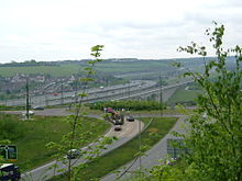
Intersecting the M2 at its second junction, crossing the A2 through the centre of Strood and meeting (and encompassing for a short stretch) the Northern Relief Road (A289).
The road to Grain was an accident black spot, this and increased traffic from the major port of Thamesport which is located to the north-west along the Medway Estuary prompted the construction of a new dual carriageway.
Design work started in March 2000 and in February 2004, contractors got under way with moving services such as water, gas and fuel pipes.
The Medway Towns Southern Relief Road was proposed to link the (then) new developments to the south of Chatham (Walderslade) and Gillingham (Hempstead, Wigmore and Parkwood) with M2's J3 and the A229 to the east and the M2's J4 and A278 in the west.
The removal of Medway from Kent (which the incomplete section would lay in) and the recent widening of M2 leaves the proposed project with little chance of completion in the foreseeable future.
They were soon absorbed by the South Eastern Railway whose North Kent line linked Strood with Gravesend, Dartford, and then London Bridge.
Subsequent rationalisation saw the closure of the LCDR's station in Strood and the SER's branch to Rochester and Chatham (although the bridge was retained and is used to this day).
Post war (1948) saw nationalisation into British Rail, which under its 1955 modernisation part saw the completion of Southern's electrification efforts in Kent as a key target.
Thamesport, which is located on the edge of the Medway Estuary on the Isle of Grain, handles the shipping of containers and fossil fuels.