Mekelle
[4] It is located around 780 kilometres (480 mi) north of the Ethiopian capital Addis Ababa, with an elevation of 2,254 metres (7,395 ft) above sea level.
[4] Mekelle is believed to have evolved from a 13th-century hamlet called Enda Meseqel (later Enda Medhane Alem), becoming a town by the early 19th century, when ras Wolde Selassie of Enderta made Antalo his seat of power, and the region of Mekelle (40 kilometres (25 mi) to the north) his recreational center.
[6][7] In the tax records of atse Tewodros II, Mekelle appears as a tributary district within Enderta with a negarit of its own.
He must have chosen the place for its strategic proximity both to rich agricultural areas (of Raya Azebo) and to the Afar salt country.
Mekelle's position on the route to Shewa, the power base of Yohannes's main rival Menelik could have been another factor.
Among the factors that further accelerated Mekele's growth and urbanization were the establishment of residential quarters by the "nobility" and court servants, the prominence of the amole salt market and the subsequent establishment of local and foreign trading and occupational communities, and Mekelle's strategic position as a transit center for commodities of the long-distance trade routes of northeastern Ethiopia, attached to the Red Sea ports, and to northern and central Ethiopia.
The new capital Addis Ababa quickly outstripped Mekelle, which, however, retained its political importance as the district and regional administration center of Enderta and Tigray respectively through the 20th century, and its economic role in the Ethiopian salt trade.
After the fall of Adwa in spring 1895, ras Mengasha Yohannes retreated from his father's capital Mekelle following the advice of atse Menelik II.
After the re-occupation of Ambalage in late 1895, the fort was besieged by Ethiopian troops, who cut the Italians' water supply.
When the Italians surrendered in January 1896, Menelik allowed them to retreat to their stronghold Adigrat, probably hoping to prevent an escalation of the conflict, and he appointed his own governor over Enderta at Mekelle, dejazmach Tedla Abaguben, in order to check the rebellious Tigrayan princes.
Likewise, he attracted various occupational groups including Muslim traders, women service vendors, and army retainers.
They built a military airport and a fort at Enda Eyesus (now the main compound of Mekelle University); reorganized roads, telephone lines, offices and residences; and installed modern water pipelines, electricity, clinics, postal services, cinema hall and resort/sport centers.
The Mekelle municipality (founded 1942), telecommunications and post office, Commercial Bank and the atse Yohannes Elementary (in 1952) and Secondary School (in 1960) were established.
In a series of offensives launched on 25 February 1988, TPLF fighters bypassed Mekelle but took control of Maychew, Korem and other places along the Dessie-Mekelle road.
In response, the Derg had a number of villages around Mekelle burned on June 4 and 5, which included Addi Gera, Bahri, Goba Zena, Grarot, Issala, and Rabea.
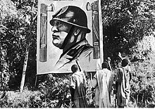
Near the end of the civil war, Mekelle was bombed by the Ethiopian Air Force on 27 and 29 October 1989, resulting in the deaths of at least 31 people.
The United Nations Mission in Ethiopia and Eritrea (UNMEE) headquarters was established in Mekelle in 2000 following the end of the Eritrean–Ethiopian War and continued until 30 July 2008.
[17] During the Tigray War, attacks were carried out on Mekelle by joint Ethiopian and Eritrean forces, including aerial bombardments.
On 19 December 2020, an EEPA report stated that Eritrean soldiers were in Mekelle, according to a resident and two diplomats receiving information from the ground.
[20] On 21 December 2020, Federal Police Crime Prevention Sector Head, Deputy Commissioner General Melaku Fanta, told local media in Mekelle that arrest warrants have been issued against anyone who collaborated with the TPLF.
[22] Mekelle lies at an elevation of 2,254 metres (7,395 ft) above sea level (at the airport), close to the edge of the northern portion of the Ethiopian Rift Valley, on a Jurassic limestone plateau, in a semi-arid area with a mean annual rainfall of 714 millimetres (28.1 in).
[23] Except for a moderately dense eucalyptus cover on the hills in eastern edges of Mekelle and some exotic species of trees and shrubs lining the streets, the surrounding landscape is almost treeless.
[24] Emperor Yohannes IV in the 19th century became Negus and built a castle and Ethiopian Orthodox Tewahedo churches in the city.
[25][26] The castle complex now serves as a museum where the Emperor's throne, royal bed, ceremonial dress, rifles, and many other valuable historical collections can be seen.
Mekelle is divided into seven local administrations: Hawelti, Adi-Haki, Kedamay Weyane, Hadnet, Ayder, Semien and Quiha.
While falling under the jurisdiction of Mekele Special Zone Government, each subcity is also a borough with its own administrator, like other cities of Ethiopia.
[14] Based on the 2007 Census conducted by the Central Statistical Agency of Ethiopia (CSA), this town has a total population of 215,914 people (104,925 men and 110,989 women).
Concerning sanitary conditions, about 88% of the urban houses had access to safe drinking water at the time of the census, and about 51% had toilet facilities.
There has been a boom in hotel services for tourism and conferences due to predominant place Mekelle holds in northern Ethiopia.
Traditionally there is a market on Saturday and Monday where a wide variety of produce and livestock is available for sale, in addition to salt from Afar.