Menstrie
[3][4] The name is composed of elements cognate to Welsh maes, meaning 'field, plain', and tref, 'town, village, farm'.
[3][5][2] Menstrie stands on the carse or flood plain of the River Devon, between 10 and 20 metres altitude above sea level.
On 29 August 2012, the burn overflowed its banks and 38 elderly residents of Menstrie House had to be evacuated to other care homes within the region.
[7][8] Clackmannanshire Council commissioned a consultants' report on the flood event and has made the summary available to the public in PDF format.
However, a large part of it is now given over to commercial forestry, with a strip of new mixed woodland planted closest to Menstrie Burn.
[10] The village has one general store (containing the post office), a pharmacy, a pub (The Holly Tree), café (Minnie's Cafe), beauty clinic (the Doll House), two take aways (Flames and Sammy's Indian Grill) and a petrol station.
In 1800, businessmen from Tullibody set up a carding and spinning mill on the east side of the Menstrie Burn to exploit its soft water and power, absent from their own village.
[13] In the 1860s a company, which included the owners of local mills and a distillery, financed a branch railway line through Menstrie to a terminus in Alva.
Practically nothing of the station remains and the railway branch line, which continued to carry freight after the Beeching Axe, fell into disuse during the mid-1980s in favour of road transport.
The Glenochil Distillery had opened in the middle 18th century on the site of the Doll Farm to the east of the village, beside the Dams Burn.
Forestry operations, including movement of heavy machinery and extraction of harvested timber would take place via widened roads and strengthened bridges on Sheriffmuir rather than through Menstrie, according to the plan.
The King's Highway (via regia in Latin) is mentioned in charters for Cambuskenneth Abbey that date to the 1300s and may have been used for royal progresses between Stirling Castle and Falkland Palace in the 16th century.
In October 2007 Clackmannanshire Council published[26] a map[27] which designated part of the railway line, by then heavily overgrown, as an Aspirational Core Path linking Menstrie and Cambus.
There is an active Community Council and a village newsletter, Menstrie Matters, published quarterly and distributed to every household.
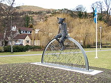
Menstrie Castle was the birthplace of Sir William Alexander, James VI's Chartered Lieutenant for the Plantation of Nova Scotia 2021 sees the 400th anniversary of this event.
Despite its name, it is described as a "three-storey castellated house",[32] and lacks many fortified features, standing as it does on low ground and constructed at a time of relative national calm.
The National Trust for Scotland operate a small museum exhibition commemorating the link between Menstrie, William Alexander, and Nova Scotia and is open to the public (on a restricted basis, two days per week) The pre 19th century bridge known as Auld Brig adjacent to the Scout Hall over the Menstrie Burn is listed by The Royal Commission on the Ancient and Historical Monuments of Scotland under number 219364.
[34] In 1874,[35] James Johnstone, one of the partners in the Elmbank Mill, had built for himself the Scottish baronial-style Broom Hall on the lower slope of Myreton Hill.
Abercombie, Cairns, Windsor, Johnstone, Holbourne, and Victoria In December 2009, Clackmannanshire Council announced an alteration to the local development plan for housing land.
Among other stipulations and guidelines the modified plan as adopted allowed for 175 housing units, 43 affordable; and required a detailed Flood Risk Assessment to determine ground conditions and water management needs on and for the site.
Among the documents relating to the application,[42] one from SEPA on 30 October 2013 stated "... we would not support the proposal to include additional properties behind the embankment as we would not consider this area to be outwith the 1:200 year flood extent.