Cliviger
Nowadays, it is mainly a dormitory area for people working in Burnley and other towns in East Lancashire and West Yorkshire.
Dr. Thomas Dunham Whitaker, historian, theologian and curate of Holme Chapel and later also vicar of the parishes of Whalley and Blackburn (until 1821), conjectured that the origin was Saxon, from "clivvig" and "shire", meaning "rocky district".
[2] However, in 1922 Eilert Ekwall felt that the name meant "steep slope farmland" having been derived from Old English clif æcer.
The remains of a Bronze Age burial mound is known to exist on Moseley Height above Mereclough and was excavated by Burnley Historical Society in 1950.
[2] Around 1160 a "plough-land", possibly the whole of the township, was granted to the recently founded Kirkstall Abbey (Leeds), and the monks made a grange here.
Later returned to them, Kirkstall would hold Cliviger until 1287, when Henry de Lacy, Earl of Lincoln promised them a fixed-rent in exchange.
[13] The de Lacy's held land in demesne here as part of the Honour of Clitheroe, which would become incorporated into the Duchy of Lancaster.
[17] Open cast coal mining took place in the 1940s and 50s above Thieveley Scout and on Deerplay Moor and were the site of two walking draglines, "Cilla" and "Charybdis".
[20] In 1897 an area of the parish including parts of the villages of Cornholme and Portsmouth,[a] was added to Todmorden thus transferring to the West Riding of Yorkshire.
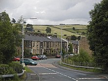
Cliviger is made up of five enumeration districts named Mereclough, Overtown, Walk Mill, Southward Bottom and Holme Chapel, the last being regarded as the village centre, with a primary school (St John the Divine C.E.
The ward elects three councillors, currently Beki Hughes and Jack Launer of the Green Party and Ivor Emo (Conservative).
[24] The Member of Parliament for Burnley, the constituency into which the parish falls, is Oliver Ryan of the Labour Party, who was first elected in 2024.
The parish is located at the northwestern entrance to Cliviger Gorge, which extends southeast to the (now) West Yorkshire town of Todmorden.
[25] The highest point in the parish is Hoof Stones Height on Stiperden Moor to the northeast, at 1,573 feet (479.5 m) above sea level (on the county boundary).
[26] A hair-raising account of a journey through the gorge on horseback is made in Harrison Ainsworth's classic novel of magic and witchcraft, "Mist over Pendle".
However a road called 'The Long Causeway' which runs above the valley (passing Coal Clough Wind Farm), is believed to be ancient in its origins, possibly dating back to the Bronze Age.
[2] Everage Clough, a tributary of the Lancashire Calder, forms the parish's western boundary as far as Crown Point, the location of the Singing Ringing Tree sculpture.
A small chapel, probably built here during the reign of Henry VIII and considered the property of the Whitaker family of the Holme, becoming ruinous, was demolished in 1788.
Today it also includes Holme Sheepdog Trials Association championship and the Thieveley Pike fell race organized by Clayton-le-Moors Harriers.
[citation needed] In June 2017, the Todmorden Agricultural Show was held in Holme Chapel, due to the organisers being unable to secure the use of Centre Vale Park in the town There appears to have been a family called "de Clivacher" in the 14th century.
Alexander converted many local First Nation Americans, including most notably Pocahontas, daughter of Powhatan, chief of the Tsenacommacah people.
The Baptism of Pocahontas is depicted in a painting of the same name by John Gadsby Chapman and now hangs in the US Capitol building, Washington DC.