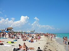
Miami Beach, Florida
The municipality is located on natural and human-made barrier islands between the Atlantic Ocean and Biscayne Bay, the latter of which separates the Beach from the mainland city of Miami.
The Historic District is bounded by the Atlantic Ocean on the East, Lenox Court on the West, 6th Street on the South and Dade Boulevard along the Collins Canal to the North.
The first structure to be built on this uninhabited oceanfront was the Biscayne House of Refuge, constructed in 1876 by the United States Life-Saving Service through an executive order issued by President Ulysses S. Grant,[10] at approximately 72nd Street.
Miami Beach then initiated the planting of a coconut plantation along its shore in the 1880s, led by New Jersey entrepreneurs Ezra Osborn and Elnathan T. Field, but the venture failed.
[11] One of the investors in the project was agriculturist John S. Collins, who achieved success by buying out other partners and planting different crops, notably avocados, on the land that would later become Miami Beach.
When funds ran dry and construction work stalled, Indianapolis millionaire and recent Miami transplant Fisher intervened, providing the financing needed to complete the Collins Bridge the following year in return for a land swap deal.
[16] Fisher helped by organizing an annual speed boat regatta, and by promoting Miami Beach as an Atlantic City-style playground and winter retreat for the wealthy.
[15] Carl Fisher was the main promoter of Miami Beach's development in the 1920s as the site for wealthy industrialists from the north and Midwest to and build their winter homes here.
The Miami Beach peninsula became an island in April 1925 when Haulover Cut was opened, connecting the ocean to the bay, north of present-day Bal Harbour.
[25][26] During World War II, Jewish doctors were not granted staff privileges at any area hospitals so the community built Mount Sinai Medical Center on Miami Beach.
[27] Post–World War II economic expansion brought a wave of immigrants to South Florida from the Northern United States, which significantly increased the population in Miami Beach within a few decades.
After Fidel Castro's rise to power in 1959, a wave of Cuban refugees entered South Florida and dramatically changed the demographic make-up of the area.
[45] In addition to present difficulty with below-grade development, some areas of southern Florida, especially Miami Beach, are beginning to engineer specifically for sea level rise and other potential effects of climate change.
Proximity to the moderating influence of the Atlantic gives Miami Beach lower high temperatures and higher lows than inland areas of Florida.
Miami Beach's location on the Atlantic Ocean, near its confluence with the Gulf of Mexico, make it extraordinarily vulnerable to hurricanes and tropical storms.
Out of the 53.0%, 20.0% were Cuban, 4.9% Colombian, 4.6% Argentine, 3.7% Puerto Rican, 2.4% Peruvian, 2.1% Venezuelan, 1.8% Mexican, 1.7% Honduran, 1.6% Guatemalan, 1.4% Dominican, 1.1% Uruguayan, 1.1% Spaniard, 1.0% Nicaraguan, 0.9% Ecuadorian and 0.8% were Chilean.
[94] Mayor Harold Rosen is credited with beginning the revitalization of Miami Beach when he notably abolished rent control in 1976, a move that was highly controversial at the time.
[98][99] Before the TV show Miami Vice helped make the area popular, SoBe was under urban blight, with vacant buildings and a high crime rate.
Lincoln Road, running east–west parallel between 16th and 17th Streets, is a nationally known spot for outdoor dining and shopping and features galleries of well known designers, artists and photographers such as Romero Britto, Peter Lik, and Jonathan Adler.
[citation needed] In 2015, the Miami Beach residents passed a law forbidding bicycling, rollerblading, skateboarding and other motorized vehicles on Lincoln Road during busy pedestrian hours between 9:00 am and 2:00 am.
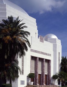
[102] In 1976, Barbara Baer Capitman and a group of fellow activists formed the Miami Design Preservation League (MDPL) to try to halt the destruction of the historic buildings in South Beach.
[102] After battling local developers and Washington DC bureaucrats, MDPL prevailed in its quest to have the Miami Beach Art Deco District named to the National Register of Historic Places in 1979.
[103] Due in part to the newfound awareness of the art deco buildings, vacationers, tourists and TV, and movie crews were drawn to South Beach.
[106] While some developers continued to focus on demolition, several investors like Tony Goldman and Ian Schrager bought art deco hotels and transformed them into world famous hot spots in the ‘80s and ‘90s.
In the Fall 1966 television season, he abandoned the American Scene Magazine format and converted the show into a standard variety hour with guest performers.
The new Gehry building offers Live Wallcasts™,[114] which allow visitors to experience select events throughout the season at the half-acre, outdoor Miami Beach SoundScape through the use of visual and audio technology on a 7,000 sq ft (650 m2) projection wall.
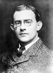
Till his death in 1991, the Nobel laureate writer Isaac Bashevis Singer lived in the northern end of Miami Beach and breakfasted often at Sheldon's drugstore on Harding Avenue.
[citation needed] The Miami Beach Jewish community had decreased in size by 1994 due to migration to wealthier areas and aging of the population.
The newcomers purchased and restored dilapidated Art Deco hotels and clubs, started numerous businesses and built political power in city and county government.
[123] It has also attracted many celebrities such as Chaz Bono,[124] Adam Lambert,[125] Gloria Estefan, Mario Lopez, and Elvis Duran who were Grand Marshals for Pride Weekend from 2012 through 2016[123][126] respectively.