Milford on Sea
Milford on Sea, often hyphenated, is a large coastal village and civil parish in the New Forest district, on the Hampshire coast, England.
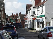
Businesses include restaurants, cafés, tea rooms, small shops, garden centres, pubs and camping/lodge/caravan parks, bed-and-breakfasts and a few luxury hotels.
In common with the flatter coast by the more commercial and eastern part of Milford, they have car parks with some facilities, which, along with many apartment blocks and houses, have close views of The Needles, which are the main, large chalk rocks immediately next to the Isle of Wight.
Bathing, when seas are calm, is favourable as tides are relatively muted for the coast at this point and thin sandbanks are nearby at lower water.
Much of the land of the parish has been recognised and protected from dense habitation by a surrounding green belt buffer zone of land, recognising its heath soil associated with the New Forest, its biodiverse wet woodland in the west (a local nature reserve which hosts badgers, fish and many bird species) and various water type marshes including an RSPB reserve in the east.
[5] In 1829 Mary Whitby purchased Milford Baddesley, re-uniting the main manors of the parish covering about half of its area, thus about 2,500 acres (1,000 ha).
[5] He inherited Newlands in 1886, and attempted to convert Milford into a premier seaside resort, changing the name of the village to Milford-on-Sea.
[6] His plans included the construction of a pier, railway station, public baths, health spa, and golf course.
[7] The scheme failed primarily due to a lack of funds and market interest,[7] but it gave Milford a layout and ordered development that lasted well into the 20th century.
[8] William's son George Cornwallis-West inherited Newlands in 1917 and, amid bankruptcy proceedings, sold it three years later.
With the advent of increasing car ownership, especially after the Second World War, the village expanded rapidly as a resort and as a place in which to retire.
[7] From most of the coast on a clear night, the conurbation of Christchurch, Bournemouth and Poole is visible from the coastal road and adjoining promenade and the brighter stars; in daytime the view extends in most weather conditions to the white cliffs and further part of the headland beyond of the Isle of Purbeck, a peninsula in Dorset.
To the east in the parish, less than a mile from the nucleated village centre, is Keyhaven which has a boatyard and half of the Lymington-Keyhaven nature reserve (or Marshes): a raised sea wall path around migratory bird shallow lakes, cattle/rabbit meadow and diverse wetland including salt marsh.
[13] The ecclesiastical parish still includes the chapelry or united benefice of Everton and the locality of Keyhaven where water dominates the land in the east.
[14] The district, for most hard communal infrastructure, education and social care (amongst other functions) is in Hampshire County Council's area.