Minetta Creek
[9] A plaque affixed to the building at Two Fifth Avenue provides one derivation of the "Minetta" name and reads as follows: A brook winds its erratic way beneath this site The Indians called it Manette or Devil's Water To the Dutch settlers it was Bestevaer's Killetje or Grandfather's Little Creek For the past two centuries familiar to this neighborhood as Minetta BrookAnother theory is that the name is an Anglicization of the Dutch root "min" or "minuut" (English: little) and suffix "-tje" to produce "Minnetje" or "The little one" to distinguish it from the Groot Kill, a large creek that was a mile away.
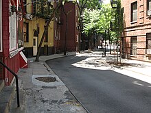
A path along the creek, called the "Negroes' Causeway", later formed the hub of the Little Africa neighborhood and now follows part of the route of Minetta Street.
At the time, the British carried out extensive defenses of the city, and according to ecologist Eric W. Sanderson, "they dammed Minetta Water to create a lake in what is now the West Village".
Murray Hoffman's Treatise Upon the Estate and Rights of the Corporation of the City of New York, as Proprietors reprints numerous historical documents from the seventeenth and eighteenth centuries, a number of which mention Minetta Creek.
[16] Most of these pre-nineteenth century documents refer to the creek by its Dutch name, Bestavaer's Killtjie (or, in a more probable spelling, Bestevaer's Killetje).
[16]The Land Ordinance of 1796 – a U.S. federal cadastral survey done for purposes of taxation, also reprinted by Hoffman – laid out the line of West Street, which had been built over landfill.
[8] The creek served as a boundary between a potter's field which was established on April 7, 1797, and was in operation until May 25, 1825, on its eastern bank, and private property to its west.
Minetta Stream had been "fully apparent; and as it was and is of considerable volume, it has been [a] very important and expensive factor in the construction of the foundations along its line, from its main source, near the site of the Union Club, to its discharge in the North [i.e. Hudson] River.
Joan H. Geismar, an urban archaeologist who wrote an archaeological assessment of Washington Square Park in 2005, hypothesized that the purpose of this sewer was in part to function as a drain directing water away from the potter's field.
[23] With the closing of the potter's field on May 25, 1825, the council chose to transform the area into a military parade ground, which eventually became Washington Square Park.
[24] By 1849, the Richmond Hill estate near the southern end of the stream had been demolished, with row houses taking its place, indicating that water no longer flowed through the area.
[19] With increasing numbers of immigrants moving to the area during the latter half of the nineteenth century, several doctors were appointed by the New York State Legislature to investigate housing conditions in tenements, and they spent many days interrogating various residents.
On October 27, 1884 they interrogated John F. Attridge, a real estate agent, on living conditions in various kinds of housing in lower Manhattan.
To this Attridge responded: "I lived for fifteen years over Minetta Brook, and the people always considered it the most unhealthy place in New York, but there was nobody sick.
"[26] In 1892, the New York Times reported the flooding of the cellar of Solomon Sayles, a merchant whose store was located at 126 Sixth Avenue, between Tenth and Eleventh Streets.
[3][27] This incident provided the Times's reporter an opportunity to speak with Egbert Ludovicus Viele, who had designed the Topographical & Sanitary Map of Manhattan published in 1865.
[3] In his 1894 book, In Old New York, Thomas A. Janvier wrote: "Although Manetta Creek no longer is visible on the surface, it still flows in diminished volume through its ancient channel—as those living near or over it sometimes know to their cost.
[30] The next year, Egbert Ludovicus Viele was again contacted concerning flooding in a construction project, and again declared the source of water to be Minetta Creek.
"[37] The construction of Jimi Hendrix's Electric Lady Studios, in 1968, had been delayed in part due to flooding attributed to Minetta Creek.