Minisink
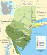
Originally inhabited by Munsee, the northern branch of the Lenape or Delaware Indians, the area's first European settlers arrived in the late seventeenth and early eighteenth centuries and were Dutch and French Huguenot families from colonial New York's Hudson River Valley.
[1][2] Earlier historians posited that Minisink meant "people of the stony country" or "where the stones are gathered together."
However, Smithsonian linguist Ives Goddard states that any of the attempts to derive either Minisink or Munsee from words meaning "stone" or "mountain," as proposed by these writers (including Lenape scholar Daniel G. Brinton), are incorrect.
It follows the southwest strike of the eroded Marcellus Formation beds along the Pennsylvania–New Jersey state line for 25 miles (40 km) to the end of the ridge at Walpack Bend in Walpack Township, New Jersey in the Delaware Water Gap National Recreation Area.
[7][8] It skirts the Kittatinny ridge, which it crosses at the Delaware Water Gap, between nearly vertical walls of sandstone, quartzite, and conglomerate.
The Ramapough Mountain Indians and the Nanticoke Lenni-Lenape, recognized as tribes by the state of New Jersey, identify as Lenape descendants.
The Delaware River is prone to floods—some resulting from seasonal snow melt or rain run-off from heavy rainstorms.
The U.S. Army Corps of Engineers proposed the construction of the dam which would have created a 37-mile (60-km) long lake between Pennsylvania and New Jersey, with depths of up to 140 feet.
In addition to flood control and recreation, the dam would be used to generate hydroelectric power, and provide a clean water supply to New York City and Philadelphia.
Approximately 15,000 people were displaced by the condemnation of personal property along the Delaware River and the surrounding area through eminent domain.
An estimated 3,000 to 5,000 dwellings and outbuildings were demolished in preparation for the dam project and subsequent flooding of the valley.
This included many irreplaceable historical sites and structures connected with the valley's colonial and Native American heritage.
Because of considerable opposition from environmental activists, the unavailability of government funding, and a geological assessment of the dam's safety given its location near active fault lines, the federal government transferred the property to the National Park Service in 1978 and the project's land holdings were reorganized to create the Delaware Water Gap National Recreation Area.