Mississippi Highway 21
It runs from north to south for 80.3 miles (129.2 km) and serves six counties: Scott, Leake, Newton, Neshoba, Kemper, and Noxubee.
The highway winds its way north, then northeast, through mostly farmland for several miles, where it crosses Tuscolameta Creek and becomes concurrent (overlapped) with MS 492 (Damascus Road) near Golden Memorial State Park, before entering Sebastopol.
MS 21 heads northeast for several miles through farmland to pass through Dixon before having an intersection with MS 485 to enter a wooded area as it passes by the Neshoba County Fairgrounds and enters the Mississippi Band of Choctaw Indians Reservation.
MS 21 passes through neighborhoods as a two-lane as it turns onto Columbus Avenue before leaving Philadelphia and traveling through an even mix of farmland and woodlands for several miles, where it has an intersection with MS 491, and crosses Bogue Chitto, before passing through Coy, where it has an intersection with a county road leading to MS 393 (Road 789, provides access to Nanih Waiya) and enters Kemper County.
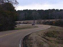
The highway now passes northeast through rugged, hilly wooded, and remote terrain for several miles to become concurrent with MS 39 and entering Shuqualak.