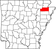
Monette, Arkansas
The first train arrived in Monette on August 19, 1898, and the town was incorporated two years later on July 3, 1900.
[5] Ecologically, Monette is located within the St. Francis Lowlands ecoregion within the larger Mississippi Alluvial Plain.
The St. Francis Lowlands are a flat region mostly covered with row crop agriculture today, though also containing sand blows and sunken lands remaining from the 1811–12 New Madrid earthquakes.
Waterways have mostly been channelized, causing loss of aquatic and riparian wildlife habitat.
[6] The St. Francis Sunken Lands Wildlife Management Area, which preserves some of the bottomland hardwood forest typical of this ecoregion prior to development for row agriculture lies just west of Monette along the St. Francis River.
As of the 2020 United States census, there were 1,506 people, 730 households, and 449 families residing in the city.
Students graduate from the Monette-based Buffalo Island Central High School.