Montaña Palentina
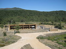
In recent years it has been provided with consolidated tourist resources and infrastructure and is committed to continuing to consider tourism as one of the strategic elements for revitalising this territory, without forgetting its integration into the rest of the region's economic activities.
[5] The highest elevations of the entire Cantabrian mountain range (excluding the Picos de Europa massif) are located here: Peña Prieta [es] (2538 m), Curavacas (2524 m) and Espigüete (2450 m).
The municipalities and their population are as follows:[8] The forests are home to a rich array of species, including oak, beech, sessile pine, holly, yew, and more.
[9] The area boasts excellent pastureland, ideal for grazing, as well as rich communities of lichens and mosses, which ensure a plentiful and high-quality supply of hunt.
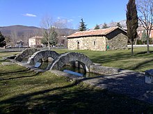
[16] However, in the 1990s, the Montaña Palentina experienced a renaissance as an area of interest for rural tourism, driven by its natural environment and historical and artistic heritage, which was leveraged as a key economic resource.