Mount Desert Island
[7] There are four towns on Mount Desert Island:[8] Deep shell heaps indicate Native American encampments dating back 6,000 years in Acadia National Park, but prehistoric data is scant.
The first written descriptions of the indigenous tribes of the Maine coast, recorded 100 years after European trade contacts began, describe people who lived off the land by hunting, fishing, collecting shellfish, and gathering plants and berries.
[9] The first meeting between the indigenous inhabitants of Pemetic and the Europeans is a matter of conjecture, but it was a Frenchman, Samuel de Champlain, who made the first important contribution to the historical record of Mount Desert Island.
On September 6, 1604 the expedition crossed Frenchman Bay and sailed towards Otter Creek, where smoke could be seen rising from an American Indian encampment.
[10] It is not clear whether Champlain sailed around the Island or was informed by the guides, but on that day, he wrote in his journal, "Le sommet de la plus part d’icelles est desgarny d’arbres parceque ce ne sont que roches.
Two months later, on July 2, 1613, Captain Samuel Argall of the English colony of Virginia arrived on board the Treasurer and destroyed their mission.
There is evidence that Claude de La Tour immediately challenged the English action by re-establishing a fur-trading post in the nearby village of Castine in the wake of Argall's raid.
Massachusetts, now independent of British rule, granted the western half of Mount Desert Island to John Bernard, son of the governor, who, unlike his father, sided with the Patriots.
Their real estate transactions probably made very little difference to the increasing number of white settlers homesteading on Mount Desert Island.
Settlers converted hundreds of acres of trees into wood products ranging from schooners and barns to baby cribs and hand tools.
Painters of the Hudson River School, including Thomas Cole and Frederic Church, inspired patrons and friends to flock here.
The rusticators returned to renew friendships with local islanders and, most of all, to savor the fresh salt air, scenery, and relaxed pace.
Not content with the simple lodgings then available, these families transformed the landscape of Mount Desert Island with elegant estates, called "cottages".
The landscape architect Beatrix Farrand, at the Cadwalder Rawle - Rhinelander Jones family summer home Reef Point Estate, designed the gardens for many of these people.
For over 40 years, the wealthy held sway at Mount Desert, but the Great Depression and World War II marked the end of such extravagance.
In 1901, George B. Dorr, disturbed by the growing development of the Bar Harbor area and the dangers he foresaw in the newly invented gasoline-powered portable sawmill, established along with others the Hancock County Trustees of Public Reservations.
Dorr offered the land to the federal government, and in 1916, President Wilson announced the creation of Sieur de Monts National Monument.
Dorr continued to acquire property and renewed his efforts to obtain full national park status for his beloved preserve.
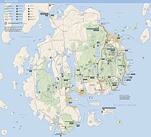
About 40 miles (64 km) of these roads are within Acadia National Park and open only to hikers, bicyclists, horseback riders, horse-drawn carriages and cross country skiers.
During the Ordovician period, the Acadian orogeny — the collision of Laurentia, Gondwanaland, and Avalonia — caused the formation to fold, thrust, and lift above sea level, where later layers were eroded away and the schist was exposed.
[22] Most recently, Mount Desert Island was host to the Laurentide Ice Sheet as it extended and receded during the Pleistocene epoch.
Other examples are the moraines deposited at the southern ends of many of the glacier-carved valleys on the Island such as the Jordan Pond valley, indicating the extent of the glacier; and the beach sediments in a regressional sequence beneath and around Jordan Pond, indicating the rebound of the continent after the glacier's recession about 25,000 years ago.
It has since been recategorized as a fjard due to the lack of an area of de-oxygenated water (dead zone), as well as the fact that the mountains on either side of the sound are not as steep as is typically expected with a fjord.