Mount Wellington (Tasmania)
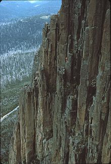
The mountain rises 1,271 metres (4,170 ft) above sea level[1] and is frequently covered by snow, at times even in summer, and the lower slopes are thickly forested, but crisscrossed by many walking tracks and a few fire trails.
An enclosed lookout near the summit has views of the city below and to the east, the Derwent estuary, and also glimpses of the World Heritage Area nearly 100 kilometres (62 mi) west.
[citation needed] The Aboriginal people of the area referred to Mount Wellington as kunanyi (or ungyhaletta), poorawetter (or pooranetere, also pooranetteri).
[3][6] The first recorded European in the area, Abel Tasman, probably did not see the mountain in 1642, as his ship was quite a distance out to sea as he sailed up the south east coast of the island – coming closer in near present-day North and Marion Bays.
[7] No other Europeans visited Tasmania until the late eighteenth century, when several visited southern Tasmania (then referred to as Van Diemens Land), including Frenchman Marion du Fresne (1772), Englishmen Tobias Furneaux (1773), James Cook (1777) and William Bligh (1788 and 1792), and Frenchman Bruni d'Entrecasteaux (1792–93).
[citation needed] In February 1836, Charles Darwin visited Hobart Town and climbed Mount Wellington.
Mount Wellington has played host to some notorious characters over time, especially the bushranger John "Rocky" Whelan, who murdered several travellers in the middle of the 19th century.
The road to the summit was constructed in the early 1930s as a relief scheme for the unemployed, an idea initiated by Albert Ogilvie, the premier of Tasmania of the day.
[11] The road carries tourist traffic during the day, and sections may be closed at any time of the year due to snowfalls or icy conditions.
Halfway up this road (at 720 metres) is a picnic area called "The Springs", near the site of a chalet/health spa that was destroyed by bushfire in 1967.
Mount Wellington was selected by many broadcasters as the site of radio and television transmitters as it provides line-of-sight transmission to a large area of Hobart and surrounding districts.
[15] The NTA tower broadcasts all of Hobart's high-power FM radio stations, plus the digital TV services for ABC and SBS.
[21] Using Otto Nordenskjöld's alternative polar isotherm,[22] it could be considered to have a subpolar oceanic climate (Köppen Cfc) or a maritime sub(ant)arctic climate (Trewartha Eo), though extreme winds—having been recorded at sustained speeds of over 157 kilometres per hour (98 mph), with rare gusts of up to 200 kilometres per hour (120 mph)—prevent tree cover.
[27] The mountain significantly influences Hobart's weather, and intending visitors to the summit are advised to dress warmly against the often icy winds.