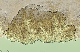
Mountains of Bhutan
The northern region consists of an arc of glaciated mountain peaks with an arctic climate at the highest elevations.
Watered by snow-fed rivers, alpine valleys in this region provide pasturage for livestock tended by a sparse population of migratory shepherds.
[3] Many lower mountain ranges are composed of coarse granite sandstone, while rocks at the highest elevations consist of gneiss among upheaved strata of mica and talcose slate.
[2][6][7][8][9]: 72, 84, 91 Despite modernization and development of transport in Bhutan, including a national highway system, travel from one valley to the next remains difficult.
These routes, being the only way into the kingdom, along with centuries-old policies of isolationism, have gained Bhutan the nickname "Mountain Fortress of the Gods."
[14] The mountains of Great Himalaya dominate the north of Bhutan, where peaks can easily reach 7,000 metres (23,000 ft).
[15] Some massive summits such as Gangkhar Puensum, Kula Kangri, and Tongshanjiabu lie in territory disputed among Bhutan and China.
[3][9]: 181 [20] Unlike the Great Himalaya, there are no glaciers in the Inner Himalayan ranges, though some summits and upper slopes are covered with moraines.
[9]: 84 [21] The steep Donga Range separates Bumthang and Lhuentse Districts and forms the watershed between the Raidāk and Manas River systems.
[9]: 84 To the east of the Manas River system, the Tawang Range (also called Kollong)[5] forms the eastern boundary of Bhutan.