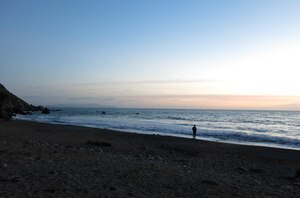
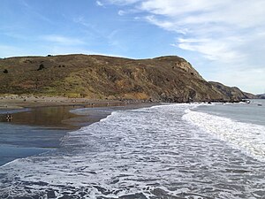
Muir Beach, California
The community is located 16.5 miles (26.6 km) northwest of San Francisco in western Marin County, California, United States.
Unlike many other entities in the area, it is not named directly in honor of conservationist John Muir; instead, it was named after Muir Woods National Monument to capitalize on the latter's popularity.
Damage from 20th century dairy farms interfered with the flow of the creek and the lagoon.
[7] According to the United States Census Bureau, the CDP has a total area of 0.5 square miles (1.3 km2), all of it land.
[3] California State Route 1 leads northeast 6 miles (10 km) to U.S. Route 101 near Sausalito and northwest 22 miles (35 km) to Point Reyes Station.
There were 162 housing units at an average density of 328.7 per square mile (126.9/km2), of which 73.8% were owner-occupied and 26.2% were occupied by renters.
Like much of the California coast, summer afternoons are often cool and windy (and sometimes foggy) as winds blow in off the ocean.
Muir Beach is unincorporated, receiving general government services from Marin County, including law enforcement, land-use planning, library, public health, and code enforcement.
A special district, the Muir Beach Community Services District, provides local services, including fire protection, water, road maintenance, and recreation.
The District has a board of directors, with five members elected to four-year terms.
The District includes all of the Muir Beach CDP, plus Green Gulch Farm.