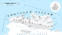
List of glaciers on Thurston Island
Glacier about 4 nautical miles (7.4 km; 4.6 mi) long flowing north from the western end of Thurston Island just east of Cape Petersen.
Named by Advisory Committee on Antarctic Names (US-ACAN) after Aviation Radarman James Haskin Robbins of the Eastern Group of United States Navy (United States Navy) Operation Highjump, aircrewman in the PBM Mariner seaplane that crashed on adjacent Noville Peninsula, December 30, 1946.
Named by US-ACAN for Stephen Sikorski, electronics technician on the USS Glacier, who assisted in setting up an automatic weather station on Thurston Island during the United States Navy Bellingshausen Sea Expedition in February 1960.
Chester Frankenfield, meteorologist on the United States Navy Bellingshausen Sea Expedition, who established an automatic weather station on Thurston Island in February 1960.
A broad glacier flowing from Zuhn Bluff into the southeast arm of Murphy Inlet on the north side of Thurston Island.
Named by Advisory Committee on Antarctic Names (US-ACAN) after Lieutenant Dale F. Mincer, co-pilot of PBM Mariner aircraft in the Eastern Group of United States Navy (United States Navy) Operation Highjump, which obtained aerial photographs of Thurston Island and adjacent coastal areas, 1946-47.
Named by Advisory Committee on Antarctic Names (US-ACAN) after Lieutenant (jg) Robert G. Goff, co-pilot of PBM Mariner aircraft in the Eastern Group of United States Navy (United States Navy) Operation Highjump, which obtained aerial photographs of Thurston Island and adjacent coastal areas, 1946-47.
Named by Advisory Committee on Antarctic Names (US-ACAN) after Photographer's Mate J.B. Payne, aircrewman in the Eastern Group of United States Navy (United States Navy) Operation Highjump, which obtained aerial photographs of Thurston Island and adjacent coastal areas, 1946-47.
Glacier about 6 nautical miles (11 km; 6.9 mi) long, flowing from the east side of Evans Peninsula on Thurston Island into Cadwalader Inlet.
Named by US-ACAN for Lieutenant Commander Robert B. Deadmond, executive officer of the USS Burton Island, forming part of this expedition.
Named by Advisory Committee on Antarctic Names (US-ACAN) after Aviation Machinist's Mate George H. Marck, aircrewman in the Eastern Group of United States Navy (United States Navy) Operation Highjump, which obtained aerial photographs of Thurston Island and adjacent coastal areas, 1946-47.
Named by US-ACAN for Lieutenant Commander William Kannheiser, United States Navy, helicopter pilot aboard the USS Glacier, who explored and photographed new Thurston Island features in February 1960.
A valley glacier about 5 nautical miles (9.3 km; 5.8 mi) long, lying west of Hendersin Knob on Thurston Island and flowing south to Abbot Ice Shelf in Peacock Sound.
Charles Craft, United States Navy, helicopter pilot on USS Glacier who made exploratory flights at Thurston Island in February 1960.
A glacier about 5 nautical miles (9.3 km; 5.8 mi) long, located just east of Hendersin Knob on Thurston Island and flowing south to Abbot Ice Shelf in Peacock Sound.
Samuel Rochray, United States Navy, helicopter pilot on USS Glacier in February 1960, who made several flights in which new parts of Thurston Island were discovered.
A glacier about 6 nautical miles (11 km; 6.9 mi) long, located just east of Mount Simpson on Thurston Island and flowing southwest to Abbot Ice Shelf in Peacock Sound.
A valley glacier about 7 nautical miles (13 km; 8.1 mi) long, flowing southwest from Mount Noxon on Thurston Island to Abbot Ice Shelf in Peacock Sound.
Named by Advisory Committee on Antarctic Names (US-ACAN) after Lynda B. Bellisime, United States Geological Survey (USGS), Flagstaff, Arizona, part of the United States Geological Survey (USGS) team that compiled the 1:5,000,000-scale Advanced Very High Resolution Radiometer maps of Antarctica and the 1: 250,000-scale Landsat TM image maps of the Siple Coast area in the 1990s.
Named by Advisory Committee on Antarctic Names (US-ACAN) after Aviation Radioman Vernon R. Hlubeck, PBM Mariner aircrewman in the Eastern Group of United States Navy (United States Navy) Operation Highjump, which obtained aerial photographs of Thurston Island and adjoining coastal areas, 1946-47.
It flows south to Abbot Ice Shelf, 14 nautical miles (26 km; 16 mi) west of Harrison Nunatak.
Discovered on helicopter flights from the USS Glacier and Burton Island by personnel of the United States Navy Bellingshausen Sea Expedition in February 1960.
Named by US-ACAN for Lieutenant John Savage, United States Navy, Dental Officer aboard the Glacier who assisted in establishing geodetic control points in the area.