Zrenjanin
Zrenjanin (Serbian Cyrillic: Зрењанин, pronounced [zrɛ̌ɲanin]; Hungarian: Nagybecskerek; Romanian: Becicherecu Mare; Slovak: Zreňanin; German: Großbetschkerek) is a city and the administrative center of the Central Banat District in the autonomous province of Vojvodina, Serbia.
[5] In Hungarian, the city is known as Nagybecskerek, in German as Großbetschkerek or Betschkerek, in Romanian as Becicherecul Mare or Zrenianin, in Slovak as Zreňanin, in Rusin as Зрењанин, in Croatian as Zrenjanin, and in Turkish as Beşkelek (meaning five melons) or Beçkerek.
The only exception makes the discovery of mammoth’s head and other bones found on the banks of Tisa River near Novi Bečej in the year 1952.
The most important archaeological site from this period is so-called Krstić tumulus, near Mužlja, about 10 km (6 mi) away from Zrenjanin.
Finally in the necropolis, not far from Aradac, “Mečka”, more than 120 graves, which date from the end of the sixth and the beginning of the seventh century, have been excavated in 1952.
The oldest written records of Bečkerek date from Budim Capitulum's document of collecting the Pope's tens taxes in 1326, 1331 and 1332.
After the Turkish victory at the battle of Nicopolis (1396) the Hungarian King Sigismund (1387–1437) was considering defending the territory settled by the Serbs, and he is known to have visited Bečkerek on September 30, 1398.
[7] The Hungarian King Ferdinand appointed friar Djordje Martinović, a commander of his forces, to defend the town from the Ottomans.
According to the Treaty of Karlowitz (1699), the Temeşvar Eyalet, including Bečkerek, stayed under Ottoman rule, while bordering territories once again came under the Military Frontier.
The District of Banat included a few settlements: Idjoš, Arač, Bečej, Itebej, Elemir, Ečka and Aradac.
After the Turkish forces and Turks families had withdrawn, the land was left devastated without labour, which could till the soil and paid taxes.
In the following years Italians, Frenchmen, Romanians arrived and then the Catalans from Barcelona, who escaped the repression after the War of the Spanish Succession and settled in a place which is now the suburb of Dolja within Zrenjanin.
The Count Mersy wanted to turn marshes into fertile soil and he began to regulate the Begej River.
During the 18th century it developed into thriving economic and cultural centre, but the great fire destroyed a large portion of the town in 1807.
Among them was Dr Emil Gavrila, who together with Svetozar Miletić and Jaša Tomić, worked very hard on the cultural and social strengthening of Serbs.
The First Army in command of Vojvoda Petar Bojović freed Belgrade on 1 November 1918 and began to occupy Vojvodina.
On 31 October 1918, the Serb Chamber of People of the town founded in the war conditions, as a temporary authority with Dr Slavko Župunski at its head.
After the Kingdom of Yugoslavia had capitulated on 18 April 1941, and Nazi Germany occupied the country, the German Forces came into Petrovgrad.
The authority in Banat had domestic Germans – Volksdeutsche, who immediately started to confiscate Jews' property and arrested patriots.
The town was renamed Great Bečkerek and it was the headquarters of the occupation authority for Banat (1941–44), headed by Juraj Špiler, and a concentration camp in Cara Dušana Street.
Eight members of the national liberation resistance, from the town and its surroundings were announced National Heroes: Žarko Zrenjanin, Svetozar Marković Toza, Pap Pavle, Stevica Jovanović, Servo Mihalj, Nedeljko Barnić Žarki, Boško Vrebalov, and Bora Mikin Marko.
After World War II important social-political changes were made in the country, which, of course, had their influence on the development of Zrenjanin, newly named in 1946.
Instead of previous large economic combines and companies plenty of new flexible private enterprises are established and foreign capital is starting to flow in Zrenjanin.
New industrial and work and residential zones are formed and the Town's General Plan 2006-2026 and Sustainable Development Strategy 2006-2013 are made and approved.
The City of Zrenjanin is situated at a longitude of 20°23’ east and a latitude of 45°23’ north, in the center of the Serbian part of the Banat region, on the banks of the Rivers Begej and Tisa.
Settlements with Serb ethnic majority are: Zrenjanin, Banatski Despotovac, Botoš, Elemir, Ečka, Klek, Knićanin, Lazarevo, Lukićevo, Melenci, Orlovat, Perlez, Stajićevo, Taraš, Tomaševac, Farkaždin, and Čenta.
The ethnic composition of the city administrative area:[14] According to the 2002 census, most of the inhabitants of the Zrenjanin municipality were Orthodox Christians (77.28%).
[15] The following table gives a preview of total number of registered people employed in legal entities per their core activity (as of 2018):[16] Zrenjanin no longer has a public transport operator, for the first time in its recent history, following the privatization and subsequent bankruptcy of Autobanat.
[citation needed] The city is served by Zrenjanin Airport, which however, as of 2023, has no hard runway, and no facilities for commercial air transport.
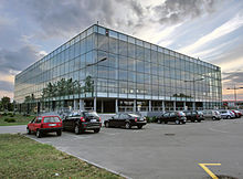
Zrenjanin has many places of interest like City Hall, the cathedral, Freedom Square, King Aleksandar I Street, etc.