Narela
[3] The 'Narela Industrial Area' started developing in the early 1980s and is today one of the important such complexes in Delhi.
Sarai Narela was important sarai (caravan rest house) on the historic and ever busy Grand Trunk Road, that stretched all the way to Lahore and Kabul and the lifeline of the empire and important trade route.
On 16 January 1757 in years preceding the Battle of Panipat (1761), in the Battle of Narela, the Maratha Army led by Antaji Mankeshwar, fought with an advance column of Ahmad Shah Abdali's army near Narela, and repulsed it.
[10] In the mid-19th century, Narela was a tehsil and flourishing market town, and at 31.2 km was the nearest town to capital Delhi, and where people from neighbouring villages flocked to buy provisions and sell their agricultural produce and its Narela Mandi (agricultural market), a tradition which continues to date.
[11] By the early 20th century, it was a municipal town and a Civil Hospital was established by the District Board in 1913.
[12] After the World War I in 1919, Narela was declared a notified area by Delhi administration, earmarked for future development.
[13] In 1860–61, the North-Western Provinces education system was abolished in Delhi, and Punjab education system was introduced with the opening of schools at Narela, Najafgarh, Mehrauli and their suburbs, several schools were opened here in the coming decades.
[14] The Hailey-Rifah-i-Am School was founded here in 1918, by Rifah-i-Am Society formed by local residents under the patronage of Lala Mussadi Lal, a noted social reformer.
[15] Swami Omanand Saraswati, a local zamindar and numberdar of villages, founded of Kanya Gurukul in Narela by donating his 70 acres (280,000 m2) of land at village., Lala Panna Lal Mangal(Kundli Wale) Freedom Fighter and Congress leader with Mahatma Gandhi,has died a decade ago.
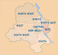
[16] After the delimitation of 2008, Narela (Nerela) is now an Assembly segment within the North West Delhi Lok Sabha constituency.
Jayender Kumar Dabas is the chairman of Narela Zone of North Delhi Municipal Corporation.
As of 2011 Indian Census, the Narela sub-district had a total population of 809,913, of which 439,576 were males and 370,337 were females.
[22] Bakhtawar Pur, Akbarpur Majra, Alipur, Bakholi, Bankner, Bhor Garh, Lampur, Budhpur, Fatehpur Jat, Garhi Khasro, Gogha, Hamid Pur, Hiranki, Holambi Kalan, Holambi Khurd, Singhola, Iradat Nagar (Naya Bans), Tajpur, Tikri Khurd, Sanoth, Jhangola, Sungerpur, Jind Pur, Singhu, Khampur, Khera kalan, kureni.